Here the sheep are black and white. A sheep mom with her two cubs. Always. Or almost. Two whites. A black. Some have two-tone wool. Where does this color change come from? The six-kilometer climb to reach the pass above Varmahlid is heavy on my legs. Yesterday’s counter-shot of the ninety-three kilometers across the Highlands, surely. At least here I am on the North Coast. The quiet coast, the coast with less traffic, the coast where the tourists do not come… I follow the road N°1 again for about twenty kilometers and it is not the great calm hoped for. Small identical 4×4 pass me at a blazing speed. And I feel disappointed to be back among tourists.
“What do you think of the two tracks crossing the Tröllaskagi peninsula?” I ask the lady who greets me with a smile at Varmahlid’s small information center. “The first is not a track, it is a path for horses, you will find yourself carrying your bike, I’m afraid,” she replies. The second, the old road, is a good track to avoid eleven kilometers of tunnel between Siglufjördur and Olafsjördur. “It’s pretty there, there is nobody,” says the lady. Exactly what I wanted to hear!
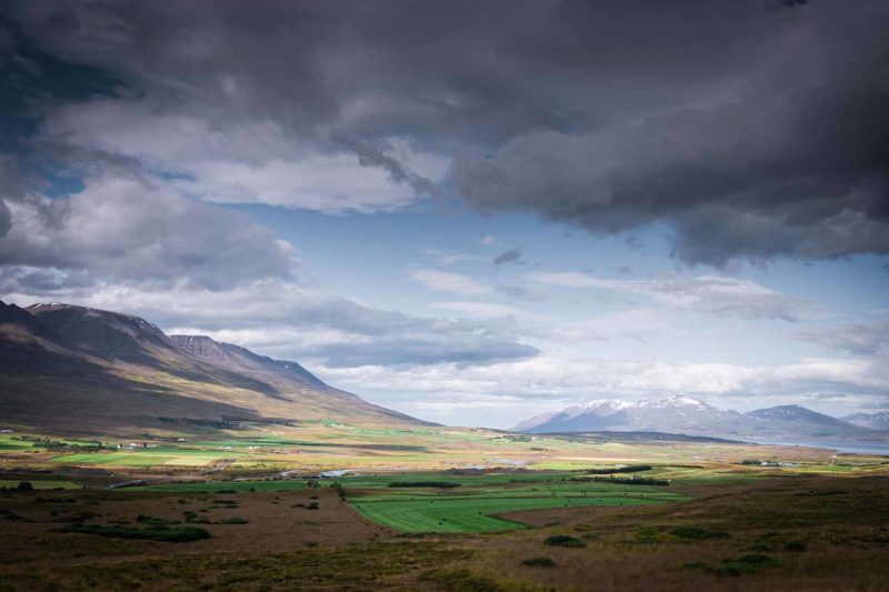
On the small hilly road along the west coast of the peninsula extend fields and meadows. It is hay season and the landscape is filled with little green and white balls. Haystacks surrounded by plastic. The smell of cut grass floats in the air. Large steep mountains stretch along the sea. No mineral desert here but a mountain atmosphere nevertheless. And a gentle breeze that slowly exhausts my strength. Hofsos, a quiet seaside town will be my first stop on the North Coast.
There is nothing to do. I can not camp in peace in a campsite. The tourist, like the sheep likes to stack on each other. My misfortune seems to come from the fact that I often arrive early, while the campsites are still almost empty. I choose a place that I find protected and not too busy. And I invariably finish in the early evening to be surrounded by sheep. Is there a solution?
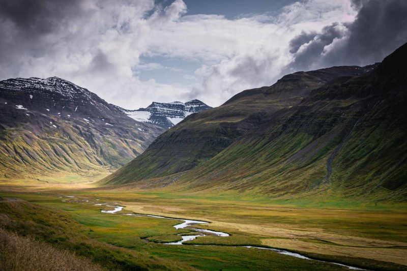
The road bypasses the peninsula along the sea. It is a beautiful weather this morning, places are bathed in a golden light. Ducks, geese, seagulls, bask on the calm blue expanse. The vegetation is flat, but there is vegetation. Mountains are covered with heather and moss and green meadows spread along the coast. I feel good in this more hospitable landscape. This is the beginning of the fjords. Inlets are sinking into the lands of the Troll Peninsula. After the Kerlingarfjöll Mountain and an Ogress that I have not seen, I intend to see a troll this time! I leave the road to follow a track. The old road, which sinks into a pretty valley. The path is hilly and it climbs hard for 500 meters. But the light is beautiful! Large clouds lit by the sun overlook the snowy peaks of the peninsula. Down in the valley, meadows are still filled with yellow flowers. A group of horses in semi-freedom graze in the distance. But no Troll. No luck. The strong wind pushes me back on my bike and I start the descent. Ten kilometers of happiness. Ten kilometers of descent almost without pedaling. In the middle of heather on the edge of a small river, I eat my lunch quietly. I have reached little farms. I am almost down to the other side of the pass in the Olafsfjördur valley. The village is pretty, placed on a tongue of land in the middle of the fjord.
The belly of the beast is dark and cold. Water seeps along the 11km tunnel from Olafsfjördur to Eyjafjördur Fjord. I pedal at full speed to try to distance the cars. There is only one way and the echo makes the noise of the engines deafening. The crossing is long and a little dangerous. I am afraid cars will not see me in the dark. But I arrive safely on the other side. Large snowy mountains face me and in the distance appears Dalvik, a small village at the edge of the sea. On the side of the road people forage in the heather. Are they picking up blueberries? I stop, looking for the little blue berry but I can not find it. What are they picking up? Mushroom ?
Along Tröllaskagi peninsula.
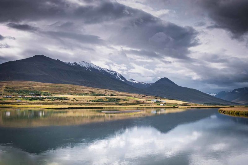
Tröllaskagi mountains.
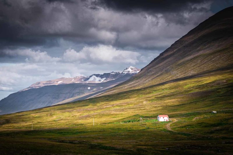
Mountains near Dalvik.
On the walls of the Dalvik campsite, it is possible to learn some Icelandic words. “Thank you”, “Takk fyrir”, is pronounced “Duck fairy” apparently. Karl, a German photographer who is passionate about whale pictures, shows me the pictures he took during the day. Only the big back tail. I spend two days in Dalvik resting after a month of traveling. I took a room at the hostel next to the campsite. There is nobody, I have the place for me alone. At noon I have lunch in a small cafe. Fish soup, an Icelandic specialty. Cod mixed with vegetables and peaches for a taste buds delight. Accompanied as a dessert with a meringue pie and fresh fruit. A pleasure after the weeks of pre-cooked meals and semolina.
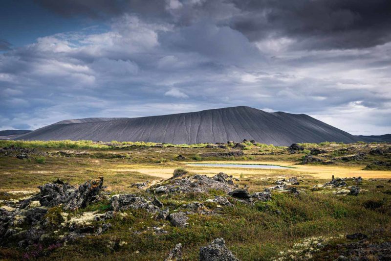
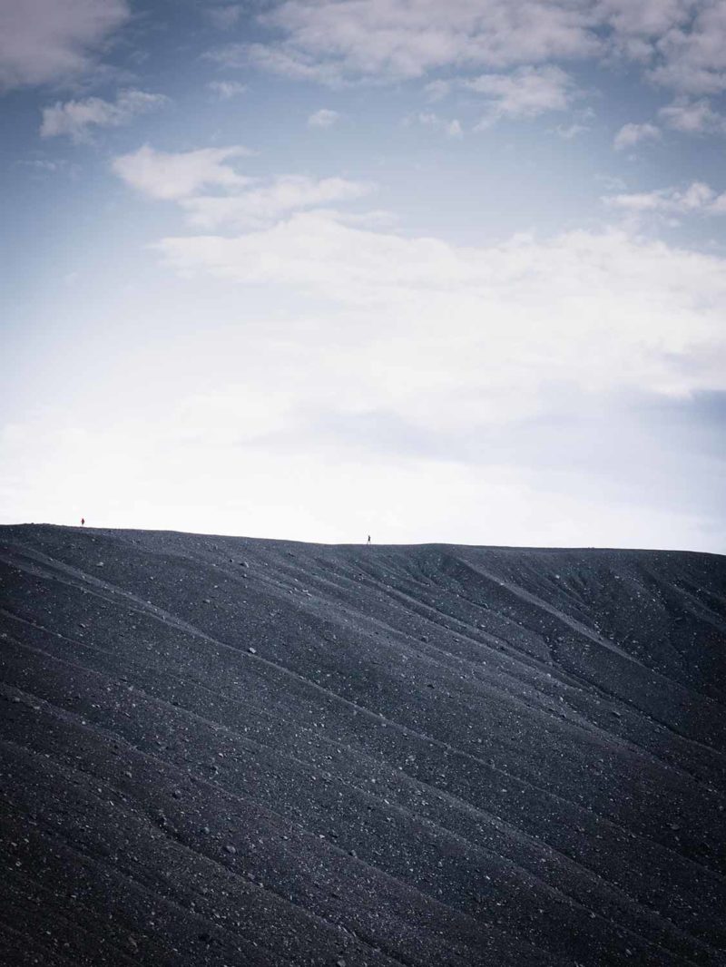
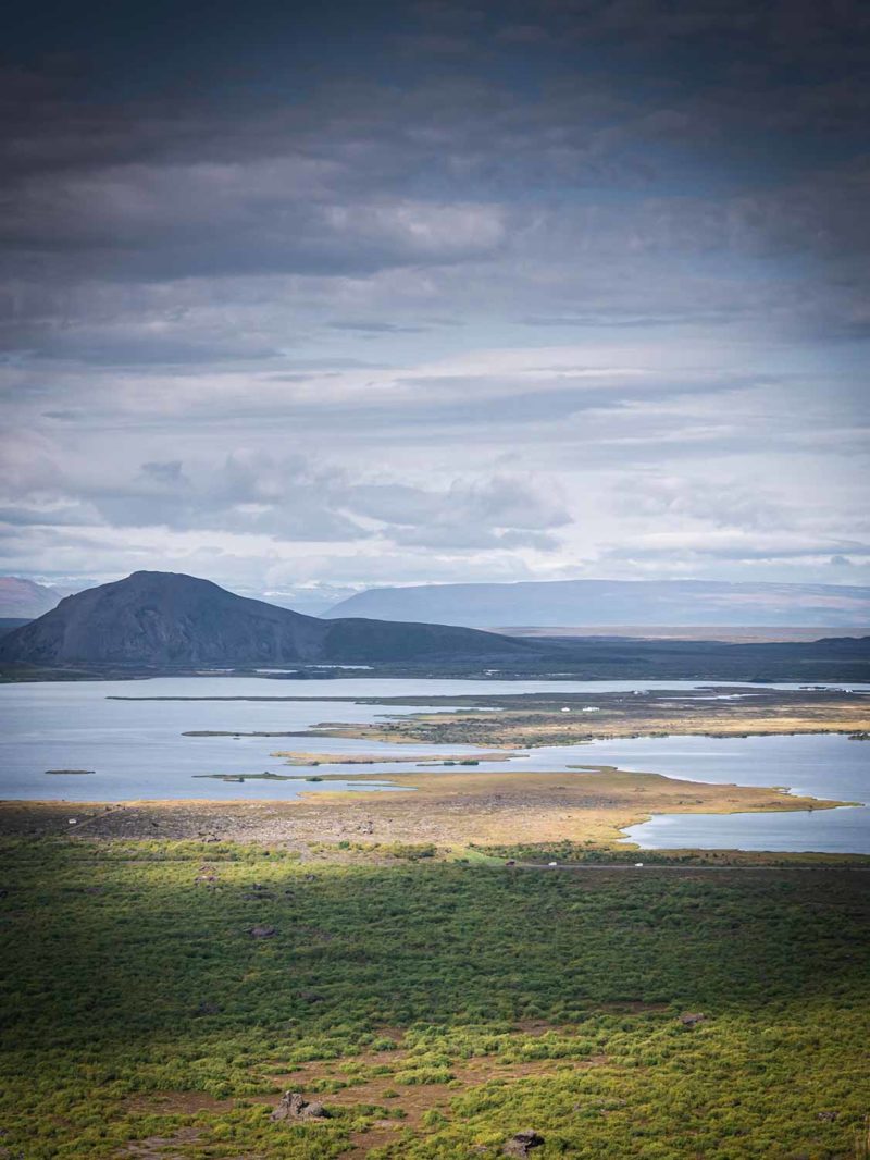
I leave Dalvik under a greyish sky to reach Akureyri, the great city of the North. Always the big mountains that rise on both sides of the fjord. The wind is strong and the road is long. Nothing special on arrival. I put my bike in a small bus to reach Myvatn. A hundred kilometers to do on the road N°1, I said no. It is still raining during the crossing but Myvatn and its big lake appear with clearings. Myvatn is the oasis of the North. A large lake full of small islets and water filled with fish, surrounded by craters and geothermal areas. I leave my bike bags at the Visitor Center and bike in the other direction to cycle around the lake. Tons of birds bask in the rough waters. Geese, ducks, hens and so many others that I do not know. A small forest of dwarf birches stretches along the road. In the distance, desert mountains block the horizon. Behind me, Hverir’s fumes are lost in the sky. Myvatn, oasis at the top of the Highlands. A mixture I like. I do not have time to stay long and I regret it a little. I pedal against the wind and stop at the bottom of Mount Hverfjall. A beautiful black crater forming an almost perfect circle. I go up on the ridge and walk around among the tourists. Further on it is Dimmuborgir, the “black city” that stops me. Large black lava pillars rise out of the ground among the dwarf birches. An Icelandic guide tells that the place is inhabited by Elves. Elves are invisible but they are here and they watch us. They live in the holes and caves that dot the place. As a child, her mother forbade her from playing in some caves. They were inhabited. Are they still?
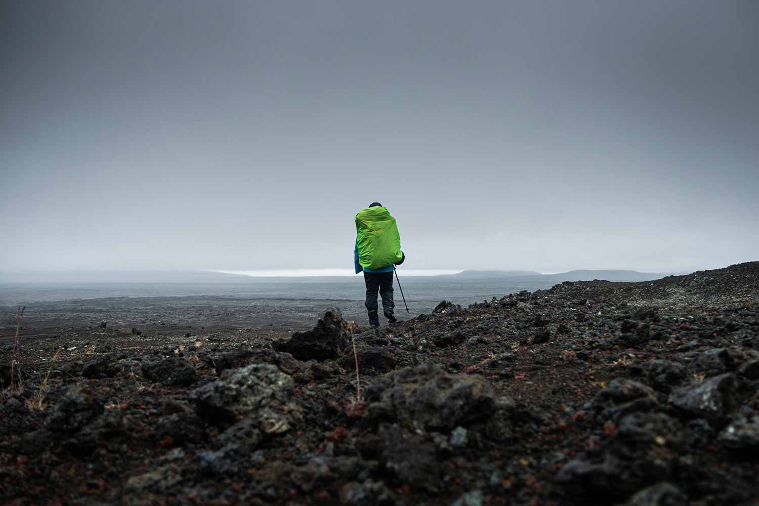
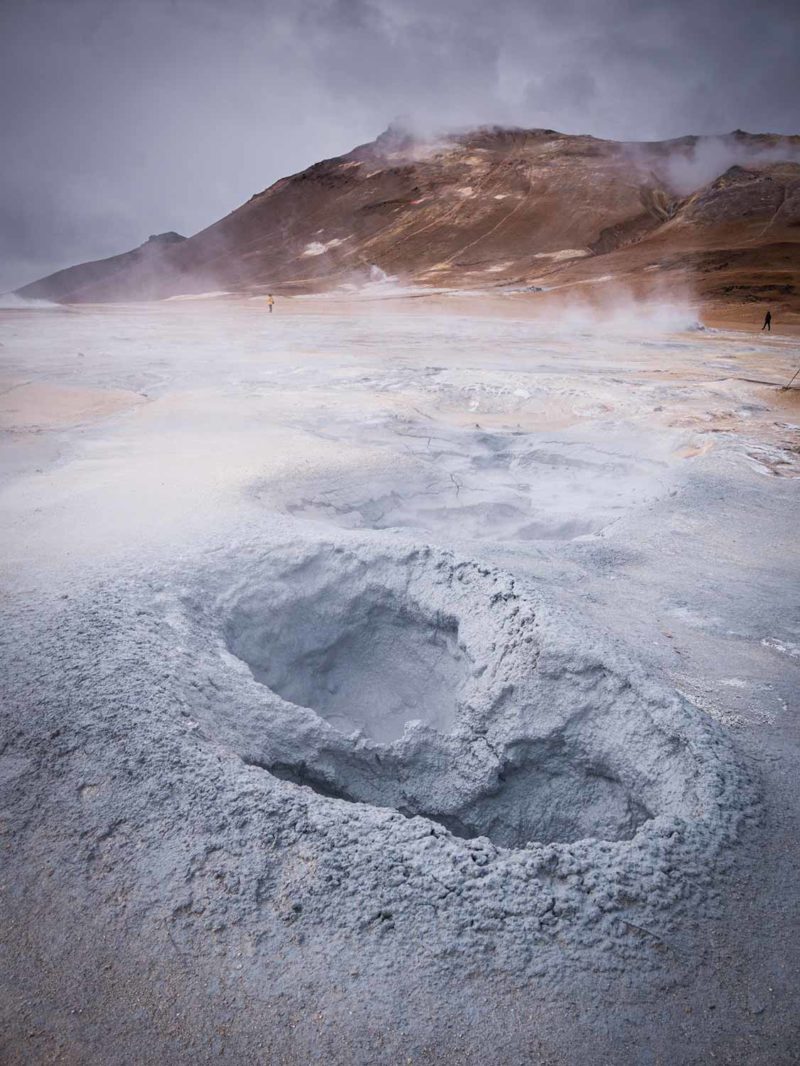
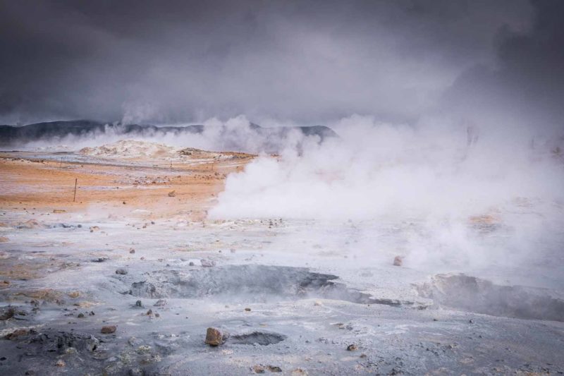
Skútustadagígar aligns a succession of pseudo-craters at the end of the lake. Very small craters only a few meters high. Formed by steam explosion when the molten lava came into contact with the waters of Lake Myvatn during old eruptions. Clouds pass over the area and I go back to Reykjahlid to get my bags back. Despite the bad weather forecast for the next few days I decided to go on a three day hike in the Askja Lake area for a last hike in the Highlands. Back for it, three days later, the weather is still bad. While waiting for the bus which is supposed to take me back to Akureyri then to the entrance of the Westfjords, I go see Hverir, the geothermal zone at the end of Myvatn town. Steam bubbles burst into holes filled with gray blue mud. Smoke envelops the place with a mysterious veil. I am cold. I got wet thanks to the rain while cycling from the village to get here. Black clouds scroll in the sky and I fell my spirit going down. I have only one desire, get to the Westfjords.
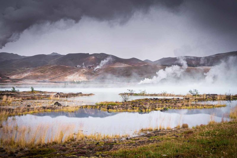
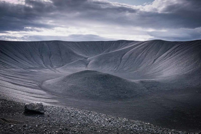
On the left, the hot springs near Myvatn and on the right, the superb Hverfell crater.
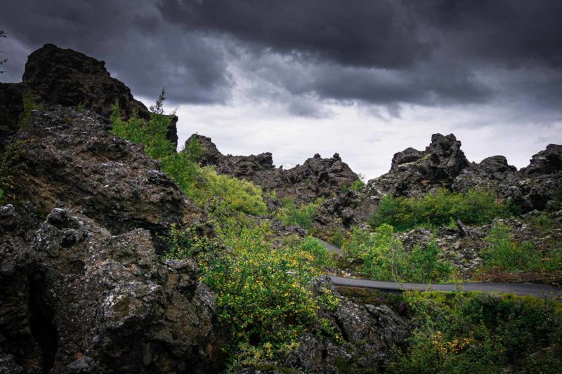
On the left, the Hverfell crater and on the right Dimmuborgir.
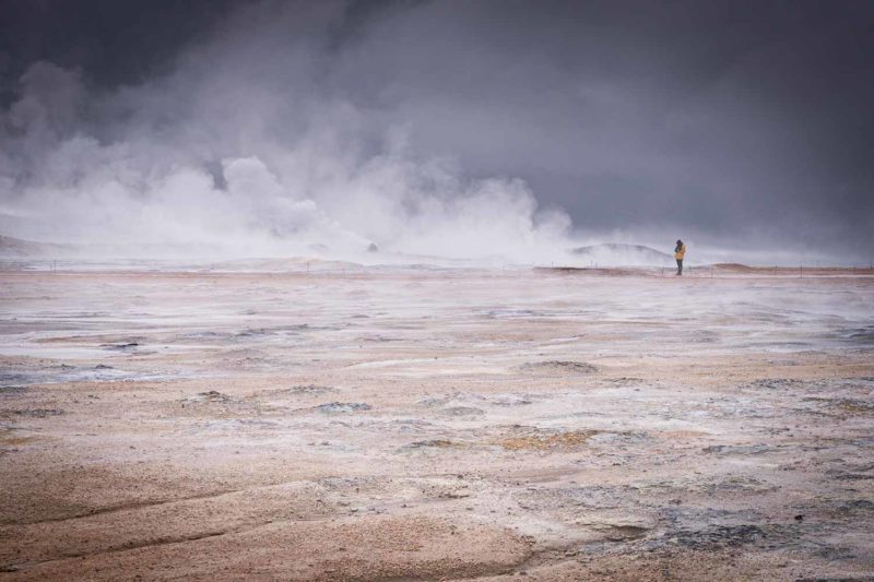
Hverir.