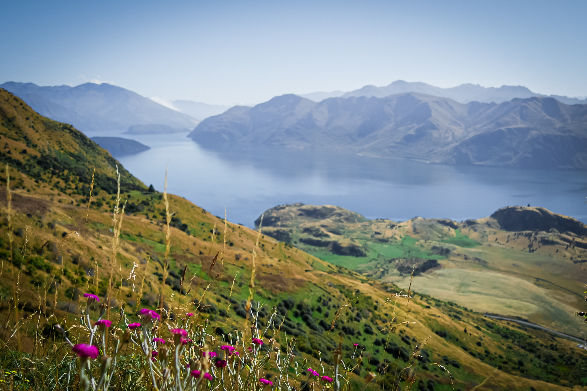
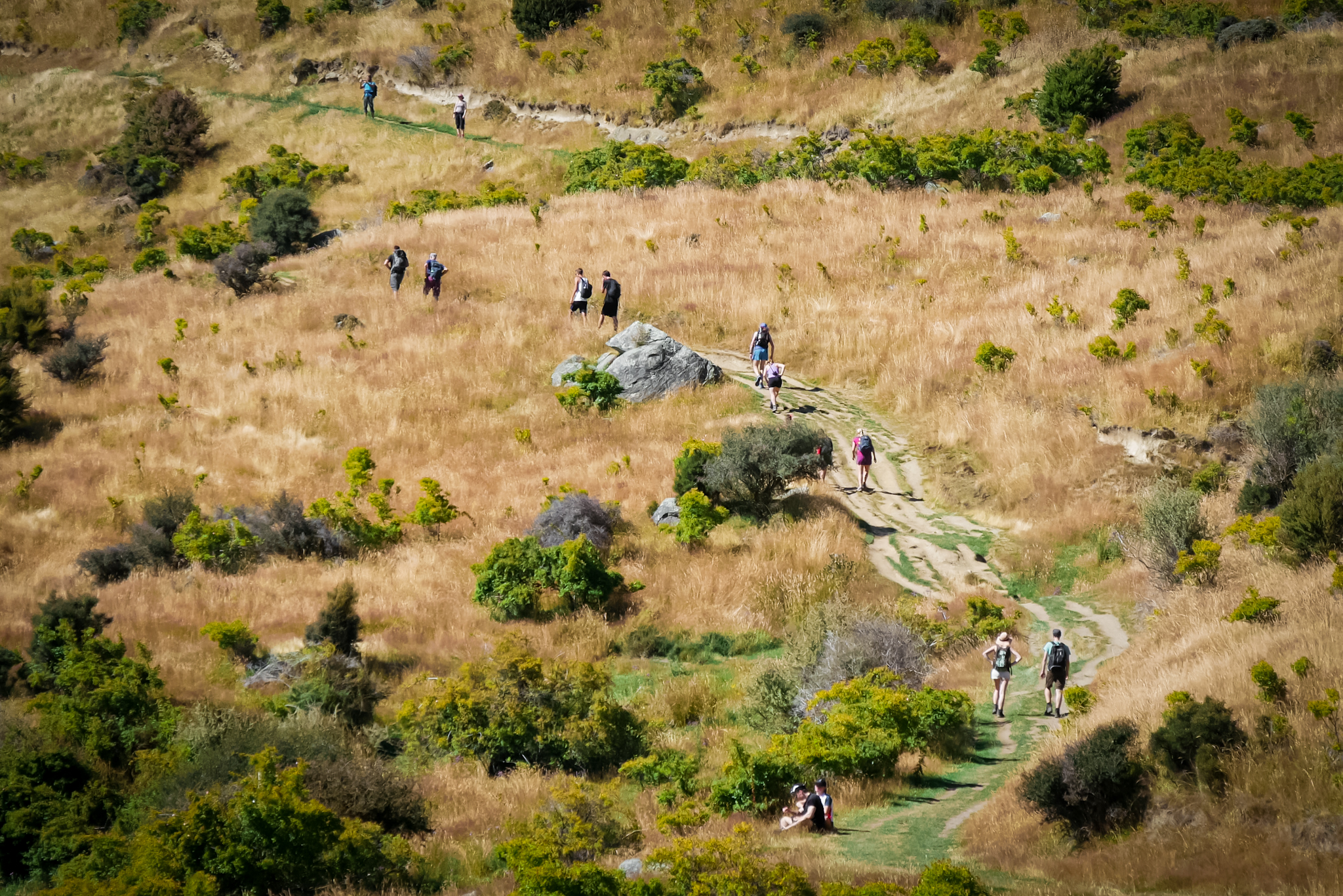
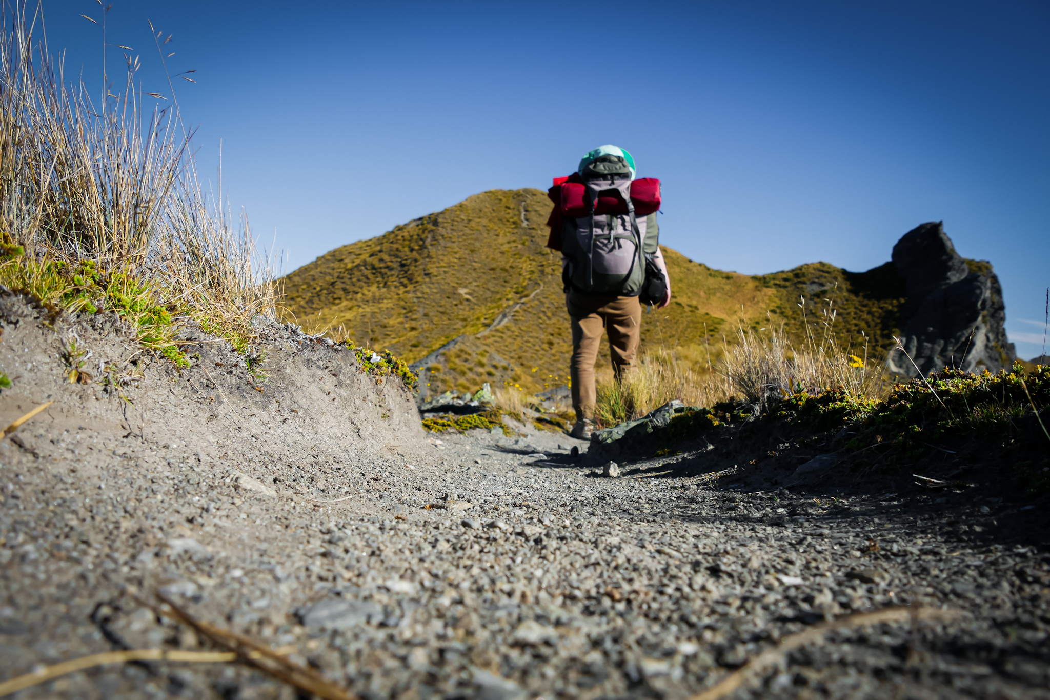
After a few days visiting the surroundings of Wanaka, I embark on the ascent of Roy’s peak / Skyline Track. The start of the hike is on the road from Glendhu Bay to Wanaka. This is probably the most famous hike in the region. It takes about five hours to reach Roy’s Peak at an altitude of 1578m and ten hours more to do the Skyline Track which continues on the ridges then descends on the Cadrona Road about ten kilometers before Wanaka. The time to pack my bag, leave my excess stuff at the campsite and reach the start of the trail, it is already 10am. The sun is shining in a cloudless sky, the day is forecast to be very hot. After following the lake I arrive at the entrance of the path. The parking lot is already full! A hundred campers, pick-ups and camper vans are on site. I did not realize it, but the hike seems to attract a lot of people. I almost advance in line. Not really my cup of tea. Especially since the road rises damn hard. The dirt road advances in steep zig-zags across the mountainside covered with tussocks. Not a tree on the horizon. At least the view is beautiful. But on the negative side, I heat up quickly.
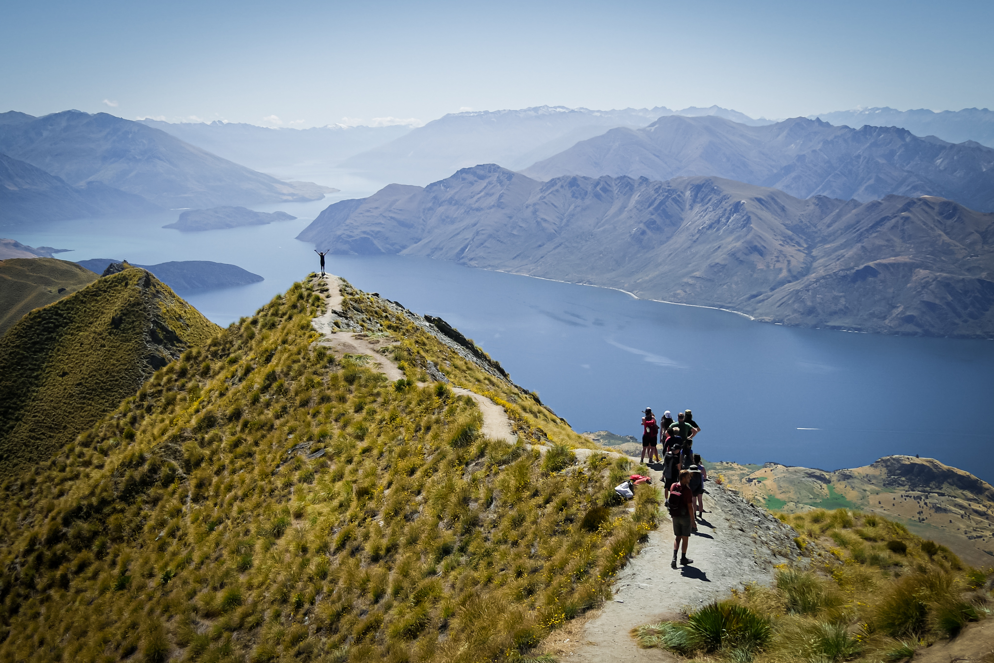
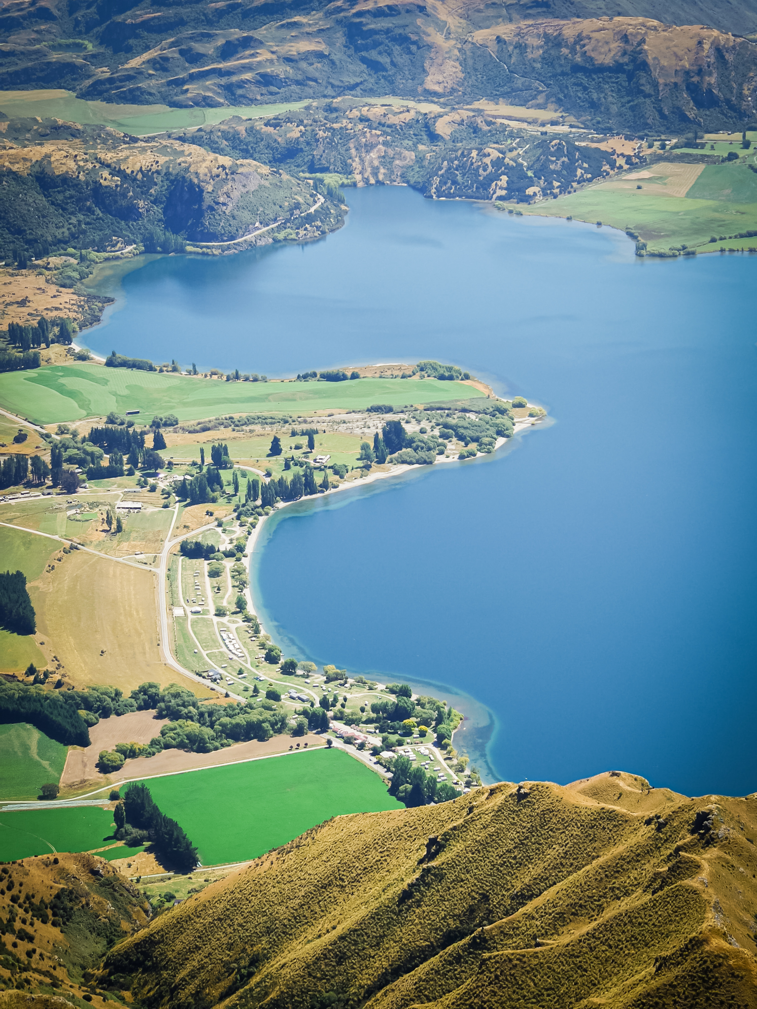
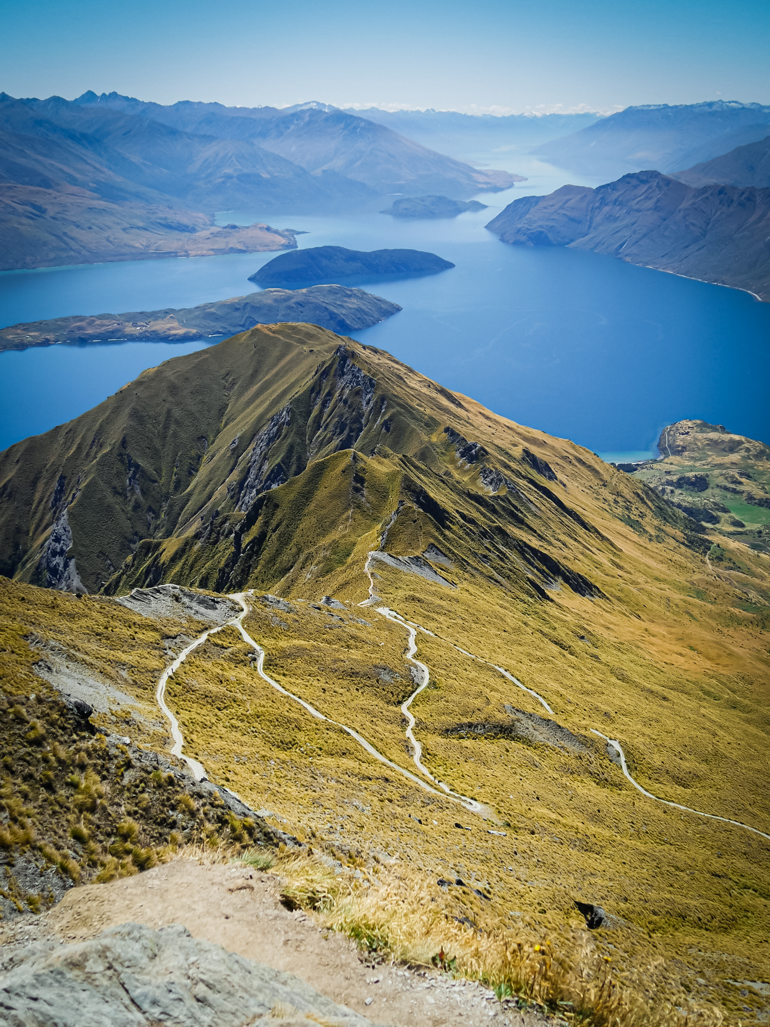
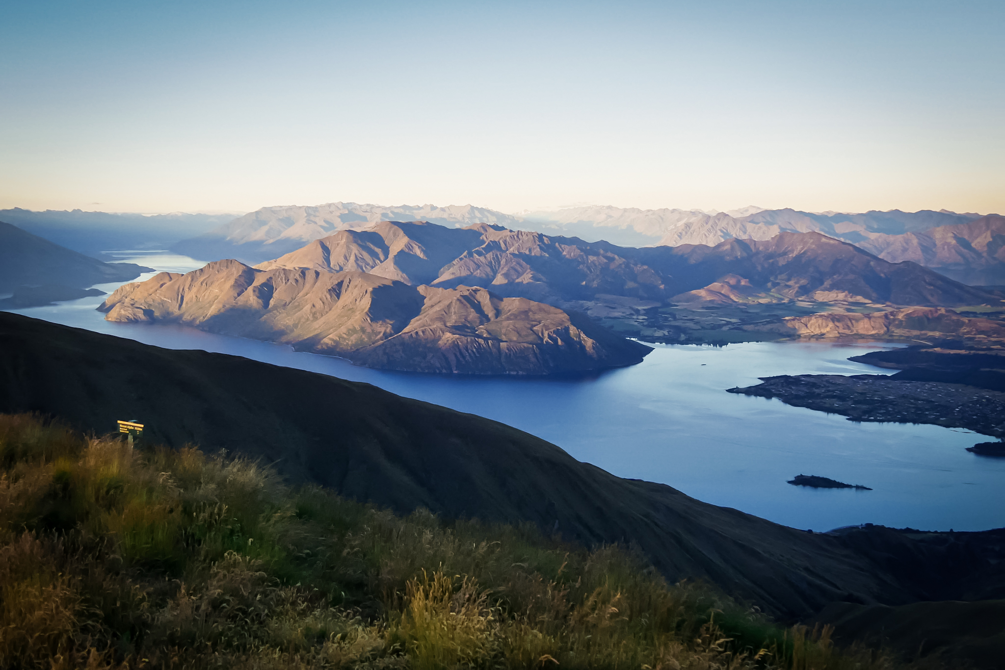
The climb is long. People look at me a little surprised. Most are in shorts and thongs with a small bag. Nothing to do with me carrying my big hiking bag. It takes me almost five hours to reach the top. But then what a view! Lake Wanaka and its various islands stretch before my view as well as the entire region of Wanaka and Glendhu Bay. The U-shaped lake, the result of glacial erosion (like most lakes in the region) is huge. A whole bunch of islands are present in the middle of the lake, from the smallest (Ruby Island) to the largest (Mou Tapu Island). The Southern Alps (the name given by the Kiwis to the mountainous region of the South Island) reveal their steep peaks with Mount Aspiring on the left. Difficult to look away from the landscape as it is so impressive. Seen from above, the Wanaka area looks almost flat. While in reality, the ground is quite wavy. I experienced it on my bicycle. The perspective is treacherous.
At the top, it is a bit like musical chairs to find a free place and take pictures without tourists in the frame. It chats in a melting pot of languages. People line up to immortalize themselves in front of the landscape. A photo seen again and again on social networks. I walk away leaving the hustle and bustle to find calm, continuing on the small path of the Skyline Track. I plan to rest until about 5p.m. while waiting for the temperature to drop. Then continue on the Skyline Track to reach Mount Alpha, spend the night bivouacking and descend via the ridges the next morning.
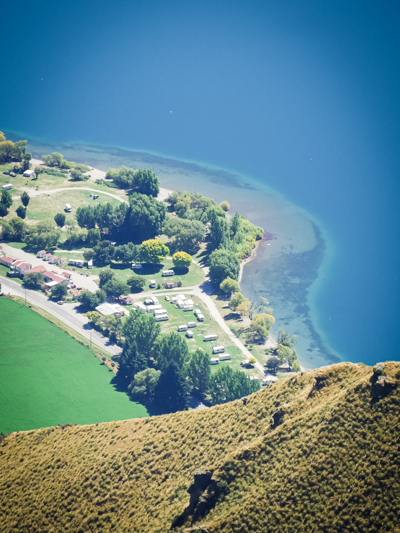
Glendhu Bay
The campsite
Roy’s peak Trail
Glendhu Bay
The campsite
Roy’s peak Trail
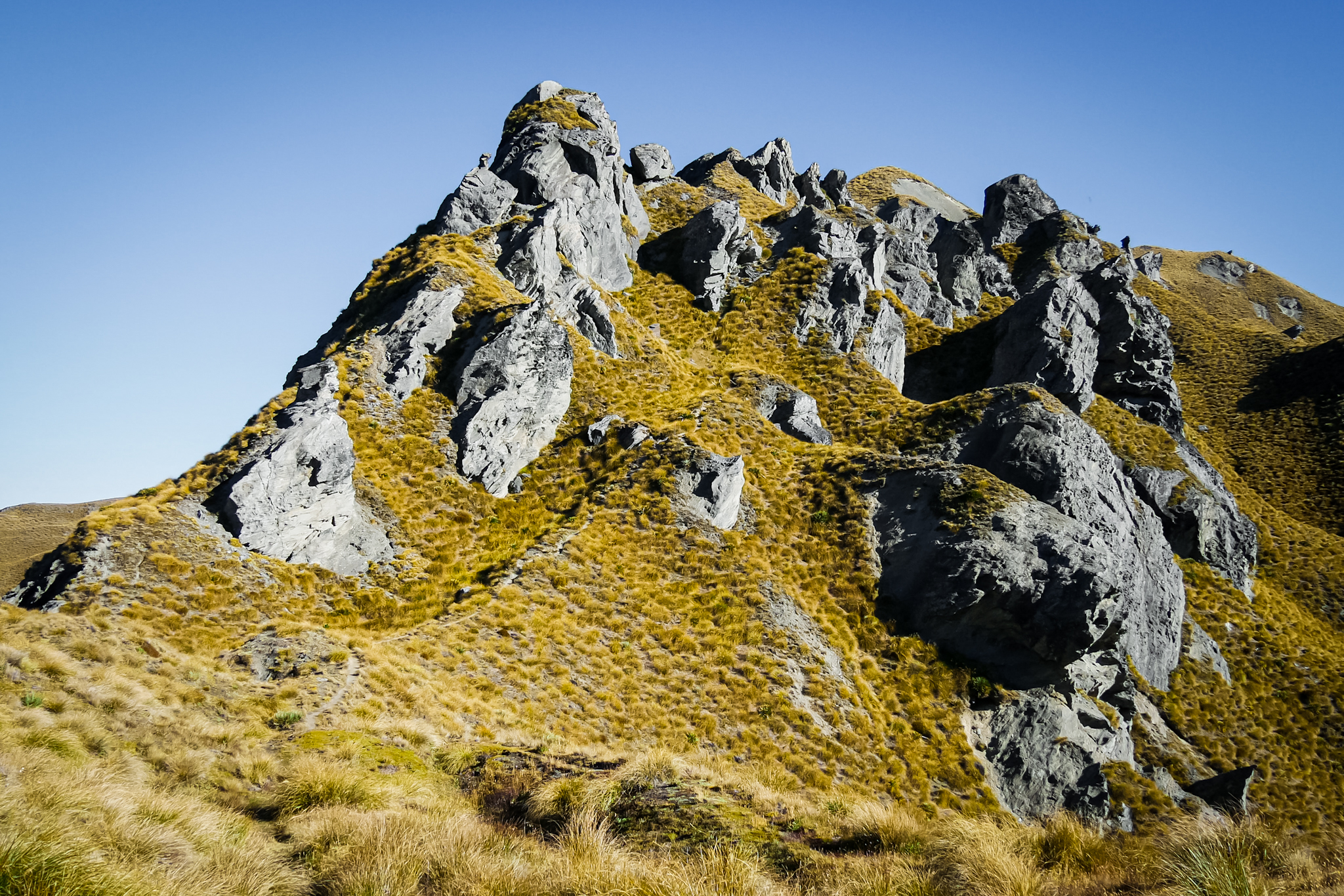
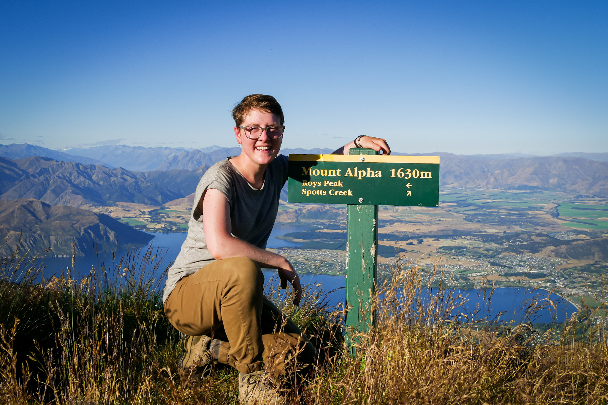
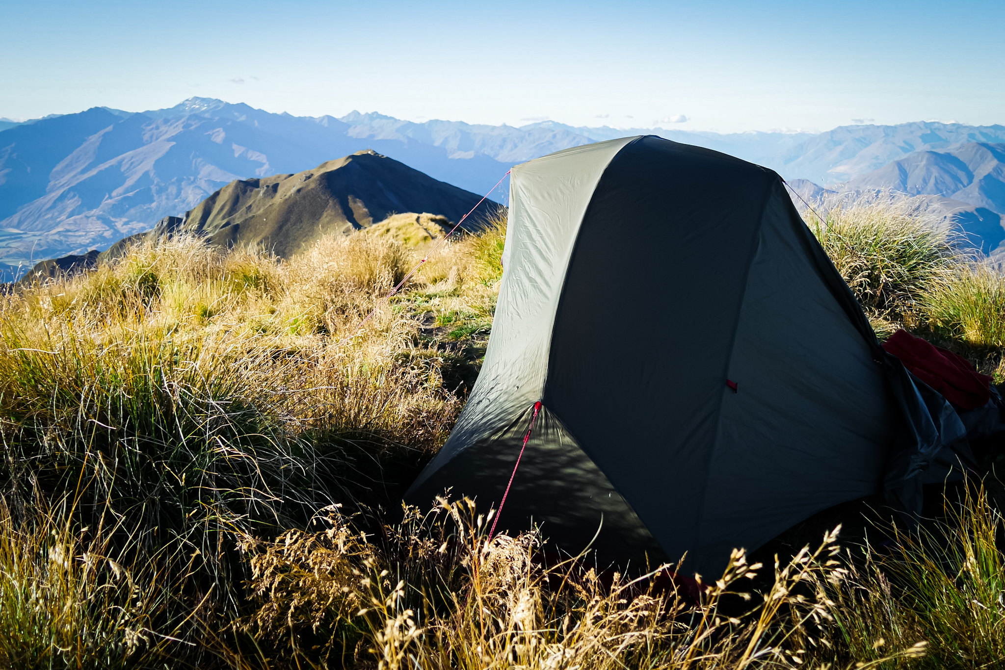
I spend two quiet hours relaxing and contemplating the landscape. Then I leave. Most people have come down, it is much quieter. In the way that I am going, there is nobody. The path becomes smaller and zigzag abruptly on the ridge. The climb to reach Mount Alpha is quite difficult because it is very steep and the ground crumbles a bit. At the end of the afternoon I finally reach the summit: Mount Alpha, 1630 meters above sea level! The view is breathtaking and apart from the screech of the cicadas, it is absolutely quiet. I set up my tent on the top, at the level of the path – the only place that is relatively flat – and I spend a perfect evening contemplating the landscape and the sunset. But the night is not going as peacefully as I had hoped. As soon as the sun disappears behind the horizon, the wind picks up and big gusts shake my tent all night. I doze, worried about the stability of my tent. The sunrise finally signals the return of the day and the appeasement of the gusts. I follow its evolution, while it gently illuminates the peaks and the valleys around me. Alone on the ridge, the world waking up and the view for me all alone, I feel perfectly fine despite the fatigue of the night.
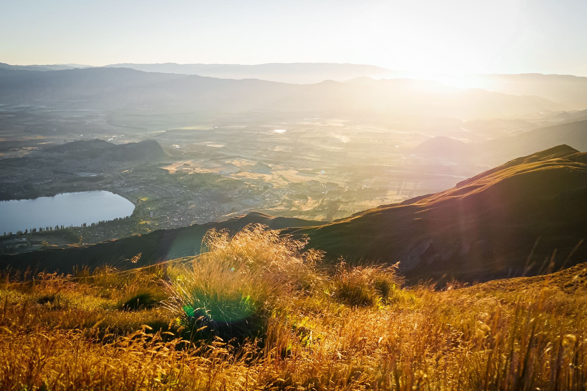
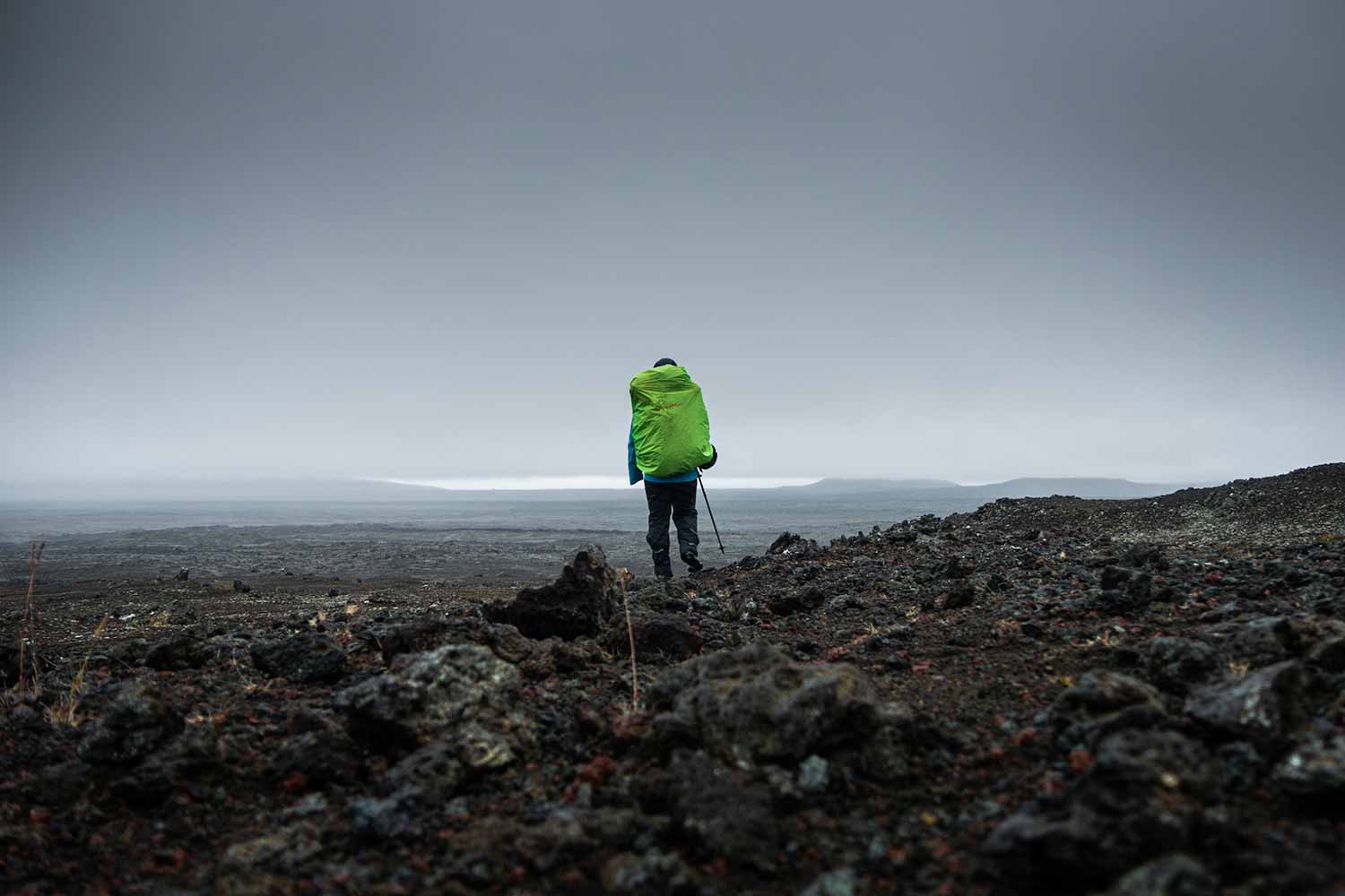
I resume the hike, continuing on the ridges, slowly descending towards the mainland. After an hour the path leaves the ridges to sink abruptly towards a cove – Spotts Creek – embedded in the mountains. The landscape loses some of its charm. The end of the journey will be much longer to reach than I imagined, the path zigzagging through the creek then across fields. Fences must be crossed several times. There is absolutely no one. I finally arrive at the small parking lot located on the edge of Cardrona Road which I followed a few days earlier. Just five minutes hitchhiking for a local guy to pick me up in his pick-up to drop me off in Wanaka. It is beautiful, very warm weather like yesterday and I am taking this opportunity to enjoy an ice cream and lounging along the lake. Hitch-hike again (barely three minutes to wait this time, definitely lucky) to return to the campground at Glendhu Bay. I can hardly believe that I have already come down. Despite a somewhat too short journey, the Skyline Track is a very nice hike to appreciate the surroundings of Wanaka.