DISPATCH

Two weeks after doing the Milford Track, I am again entitled to four days of rest with my work at the Lakeview Holiday Park in Te Anau. From Saturday 12 to Tuesday 15 of November. The weather is forecast to be fine and I decide to do the Routeburn Track, the third Great Walks of the Fiordland region. Being now in the summer season (since October 25), I must reserve my place in huts or campsites along the way. Having received my brand new tent (Hubba NX Solo from MSR) a week earlier, I opt for campsites. The place costs $ 18 compared to $ 54 in a hut! Along the trail are two campsites: one of nine places at Mackenzie Lake and one of fifteen places at Routeburn Flats hut. So I check on the DOC (Department of Conservation) website to check availability. There are still places available for the Routeburn Flats but nothing for Lake Mackenzie. The next available place is at the end of January! Since the Routeburn Flats campsite is near the end of the hike, I have to do almost the entire hike in one day! The other possibility is to bet on luck and hope for a withdrawal at the Mackenzie Lake campsite. While talking to Lenka, one of the ladies who works with me at Lakeview Holiday Park and whose companion is one of the guardians of the Mackenzie Lake hut, I learn that in the last few weeks many reserved campsites have been left vacant. Apparently a lot of people are not coming and that suits me greatly. So I decide to bet on luck.

Saturday, wake up early to board a Tracknet shuttle at 7am. Contrary to what was announced, it is cloudy and raining a bit. The Routeburn Track is a thirty-kilometer hike through peaks and valleys starting at The Divide and ending at the Routeburn Shelter, which can also be done in reverse. The Divide is a stop along Milford Road that leads to the fjord of the same name that I start to know quite well after visiting it two times already. At The Divide, a whole group of cyclists is preparing for a race. The path climbs into the forest along the valley. The weather is quite strange mixing sunbeams and light rain. After an hour of climbing, I arrive at a fork: a path offers to go see Key Summit about thirty minutes from here. I opt for the detour. It is hot on the climb and the view of the valleys below is superb. But a gigantic mass of gray clouds seems to loom over the mountains of the Routeburn Track.

Arriving at the summit (919m above sea level), I am greeted by gusts of wind and rain. The path makes a loop on a small plateau to appreciate small lakes and marshes, the view of the surrounding peaks, as well as Lake Miriam on the other side of the valley (a pretty lake in the bottom of a glacial valley). A superb rainbow spans the valley. It is one of the biggest I have ever seen in my life. The beauty makes me forget the cold that pierces me on all sides. I descend from Key Summit and take the main trail. Fifteen minutes later, I arrived at the Howden chalet by the lake of the same name. From there it is possible to start the Greenstone / Caples hiking trail which makes a loop in the valleys of the same name or to continue on the Routeburn Track. A cold wind refreshes me and I continue the climb. It is 11 a.m., I have the whole day in front of me. The climb is quiet, mainly on the hillside, alternating passages in the New Zealand beech forest (which I am starting to know perfectly after three hikes in the same type of vegetation), and passages in the open air with a superb view of mountains. The weather is better but a light rain is constantly falling. I meet a lot of people who almost all go in the opposite direction of mine.

I arrive at Earland Falls, a 174m waterfall that I find damn impressive. Almost more than the Sutherland Falls on the Milford Track. The water makes a deafening noise as it pours into the river below. Around one o’clock in the afternoon, The Orchard, a small open area covered by a meadow with large yellow grasses, shows up for a meal break. I reach the hut around 3:00p.m. I pass the lodge (a gigantic, super-cozy thing with restaurant) reserved for hikers with a guide and arrive at the hut on the shore of Lake Mackenzie, a large lake in the bottom of a plateau with waters with superb blue reflections.

Since I do not have a reservation for the campsite, I have to find the refuge keeper to chat with him. Alas, he is not around right now. I go see the campsite, about ten minutes from the hut. Nine well-defined pitches are available by the lake in a quiet corner. A couple is setting up their tent on one of the pitches. Not many people yet. I cross my fingers very strongly. I take the opportunity to go see Split Rock fifteen minutes away. A huge rock split in two with an impressive fault. Back at the chalet around 4p.m., still no guard in sight. I chat with an Irish lady who tells me that one of the locations is available! A father and his son, supposed to sleep in a tent, finally decided to sleep in the chalet! The lady also tells me that the keeper has probably gone to work somewhere in the mountain (maintaining the path or renewing traps to capture pests) and that he usually returns around 5pm. So I wait basking in the sun on the veranda of the chalet while waiting for the guard to return. The weather is nice (although the very light rain is still present) and the atmosphere is very peaceful. Only interrupted by the cries of some brave hikers who decided to take a dip in the lake and realized too late that the water was icy cold.

At 5pm sharp, the guard appears covered in dust and I give him a little time to clean himself before asking him my questions. I explain my case to him by specifying that I am willing to pay the “penalty rate” (which corresponds to twice the price of the campsite, so $ 36 instead of $ 18 for people who have not booked in advanced). He says that I can take the available space, he will come and collect the money later. Luck smiles on me. I return to the campsite with a light heart and set up my new tent under a drizzle a bit stronger than before. It rains for a good hour but the sun is still there. A little later, the guard comes to visit me and only charges me $ 18. As I have a reservation for tomorrow evening and the campsite here this evening being not full (there are three free pitches left), he is indulgent with me. I dine quietly enjoying the view of the lake and the superb surrounding mountains and I go to bed. Not so many stars in the sky tonight. The almost full moon diffuses a powerful light and some clouds appear in the sky.

I wake up after a rather pleasant night and leave around 10am, under a nice sun. Lake Mackenzie gives me great reflections and the light is incredible. The first part of the trail climbs rather steep, making laces through a superb beech forest covered with moss. It is damn hot. After half an hour under the canopy of trees I reach the edge of the forest and continue through the mountain pastures covered with yellow herbs. The view of the valley and Mackenzie Lake is magnificent. Byclimbing up, you realize the differences in color of the lake. The borders are turquoise green, while the center is deep blue. The lake must be very deep. It is absolutely beautiful. I spend a long time contemplating this gradient of colors, the intensity of which changing with the passing of the clouds.

The path continues on the hillside along the mountains with a superb view of the Hollyford valley below. This is the kind of hike I prefer. High up in the mountain pastures or on the ridges, the view is always fantastic. Light-hearted and a little euphoric, I quietly walk the two hours on the side that separates me from Harris Saddle. I come across a lot of hikers again, including groups with a guide, but the atmosphere is calm. The weather is magnificent with a little breeze that strengthens at times. About thirty minutes from the pass, I pass a sign indicating to the left: “Deadmans Track”. The path is aptly named since it is almost unmarked and descends steeply through the grass. The path leads back down into the Hollyford valley. It is not marked on the DOC map. Probably too difficult for basic hikers and reserved for experienced ones.

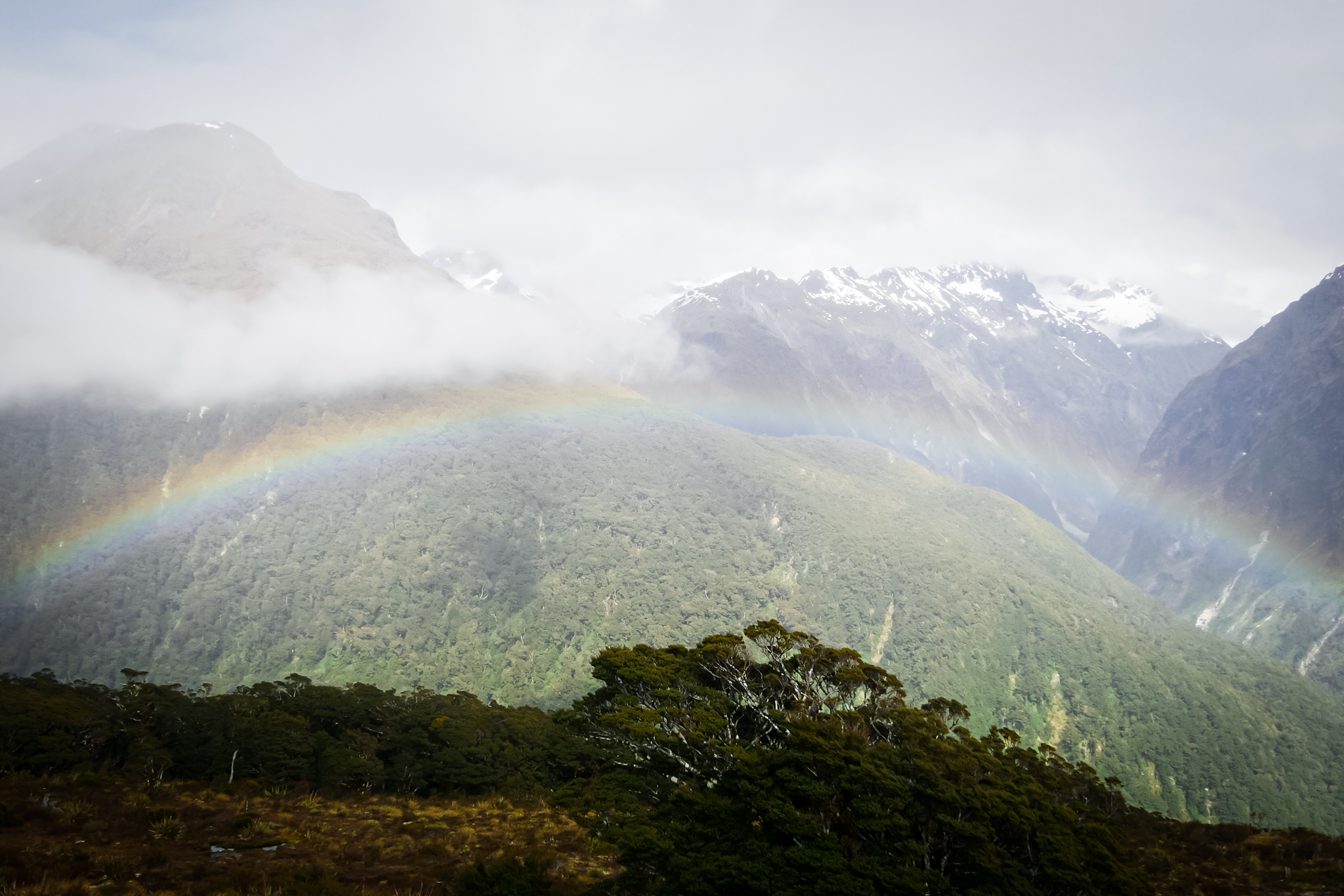
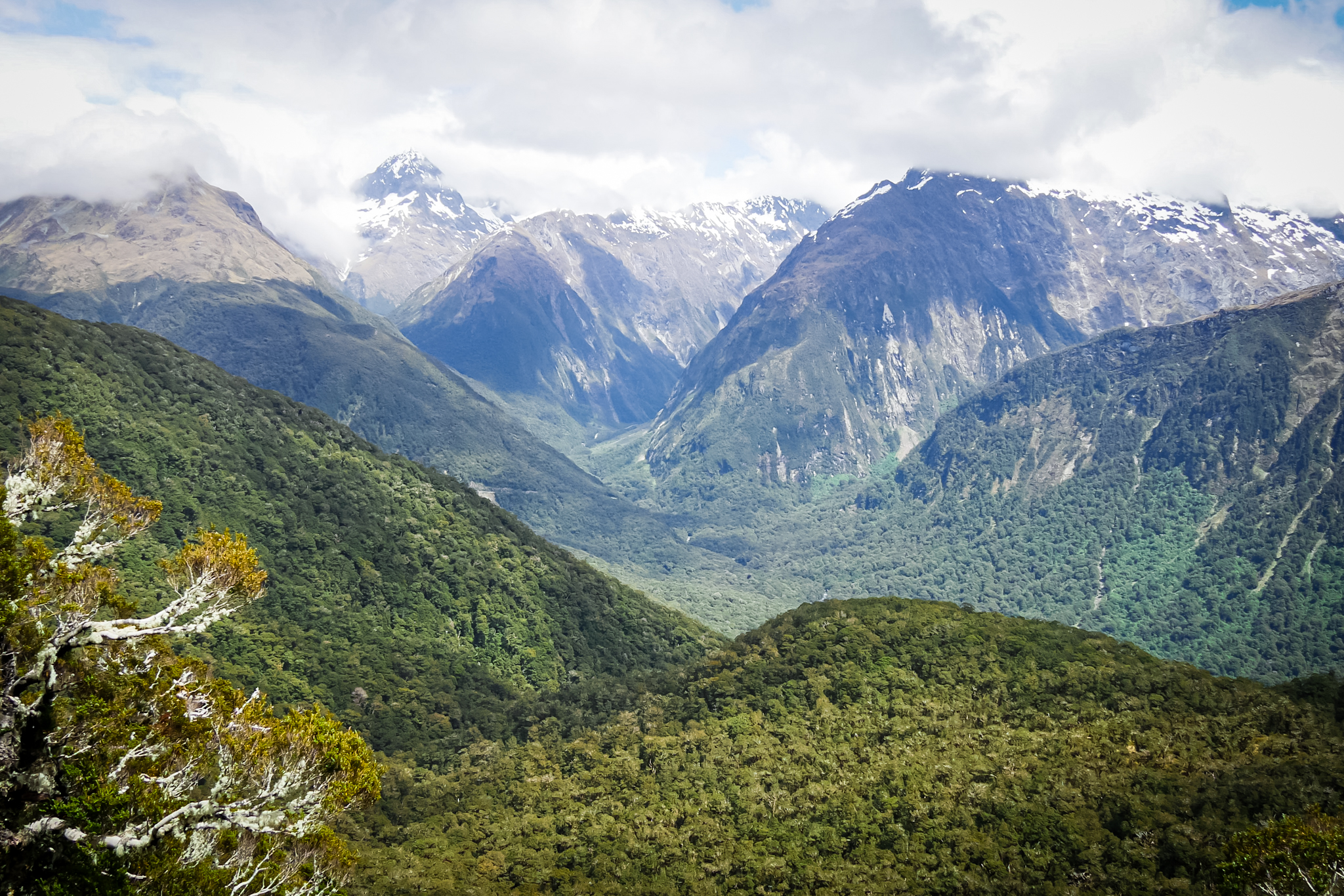
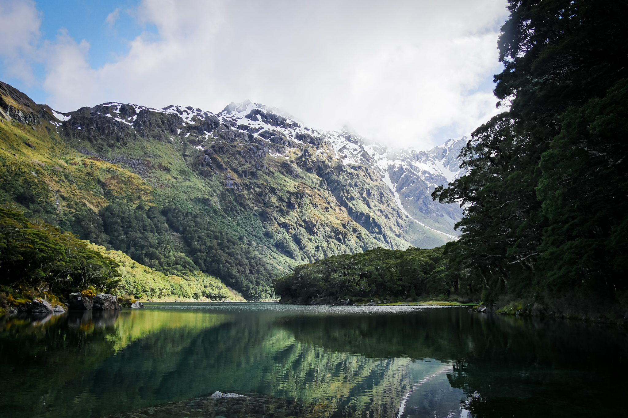
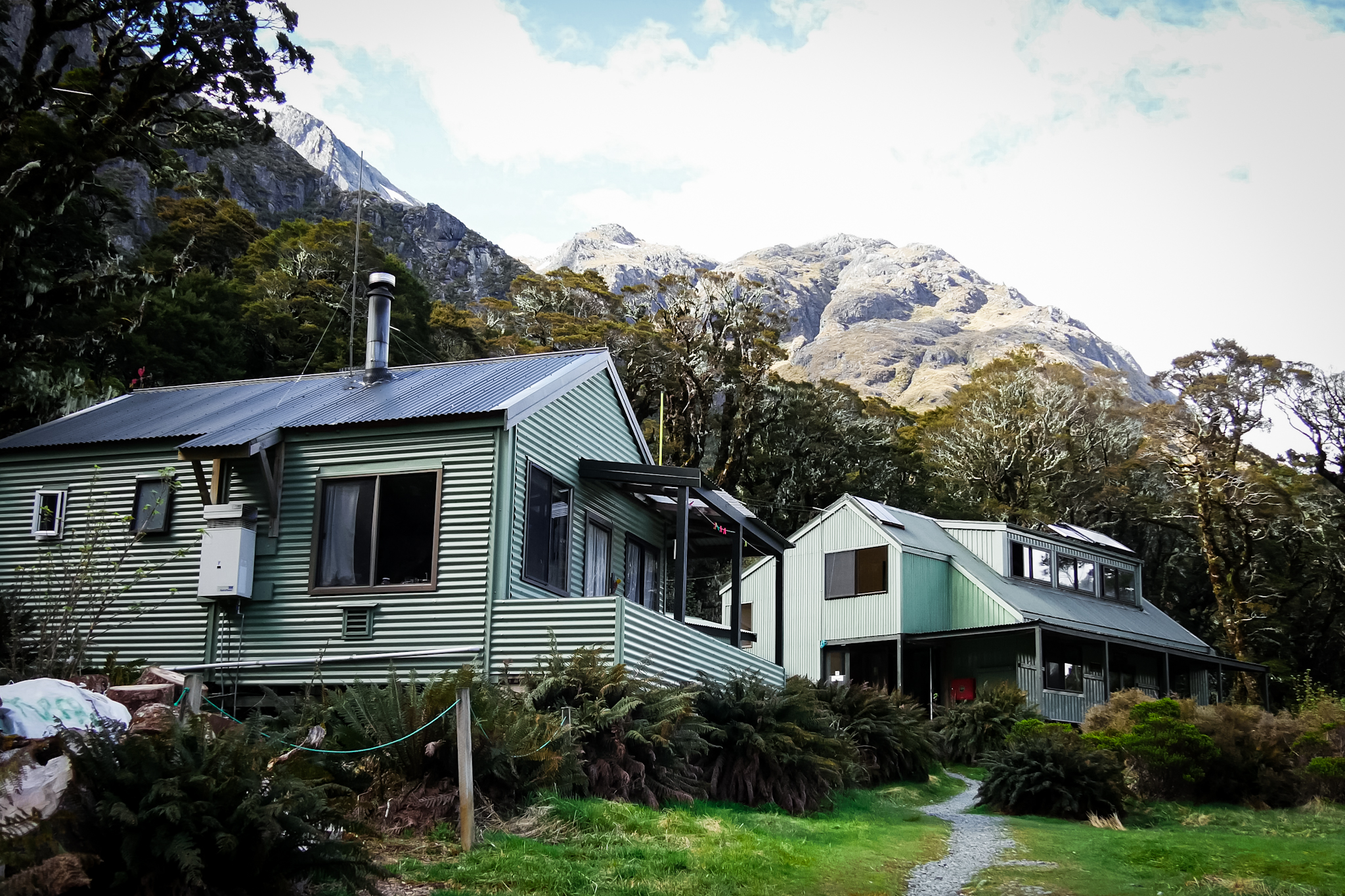
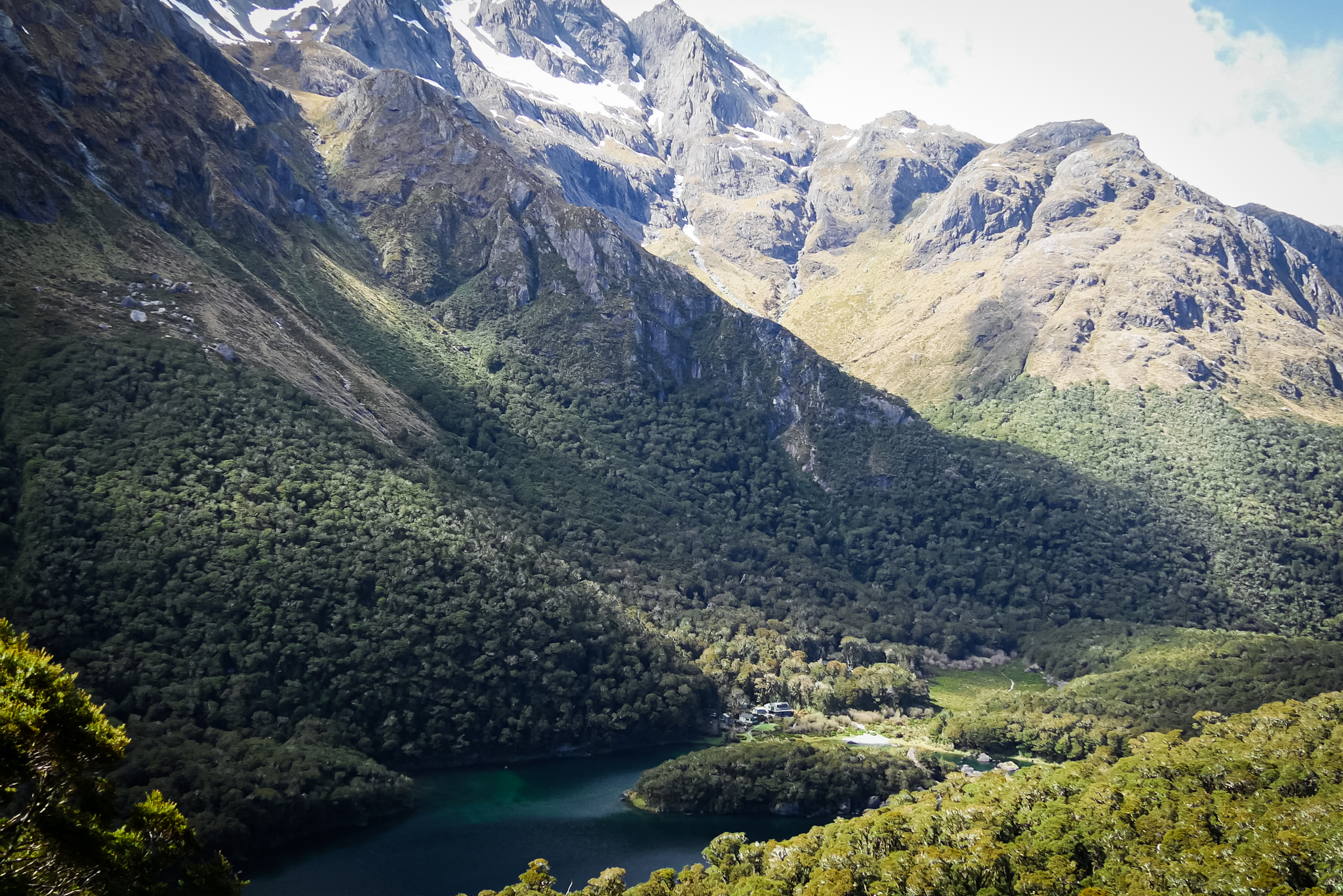
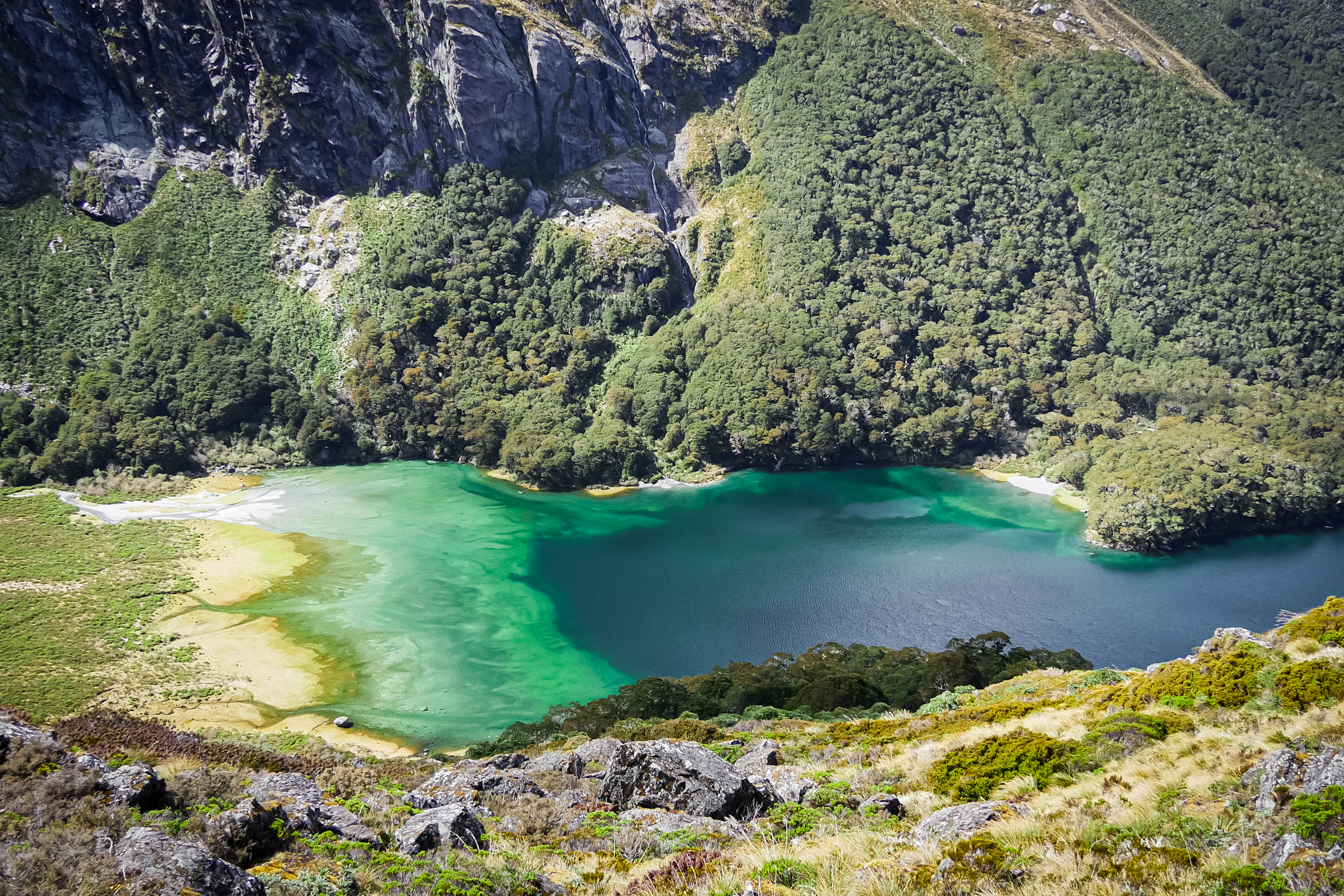
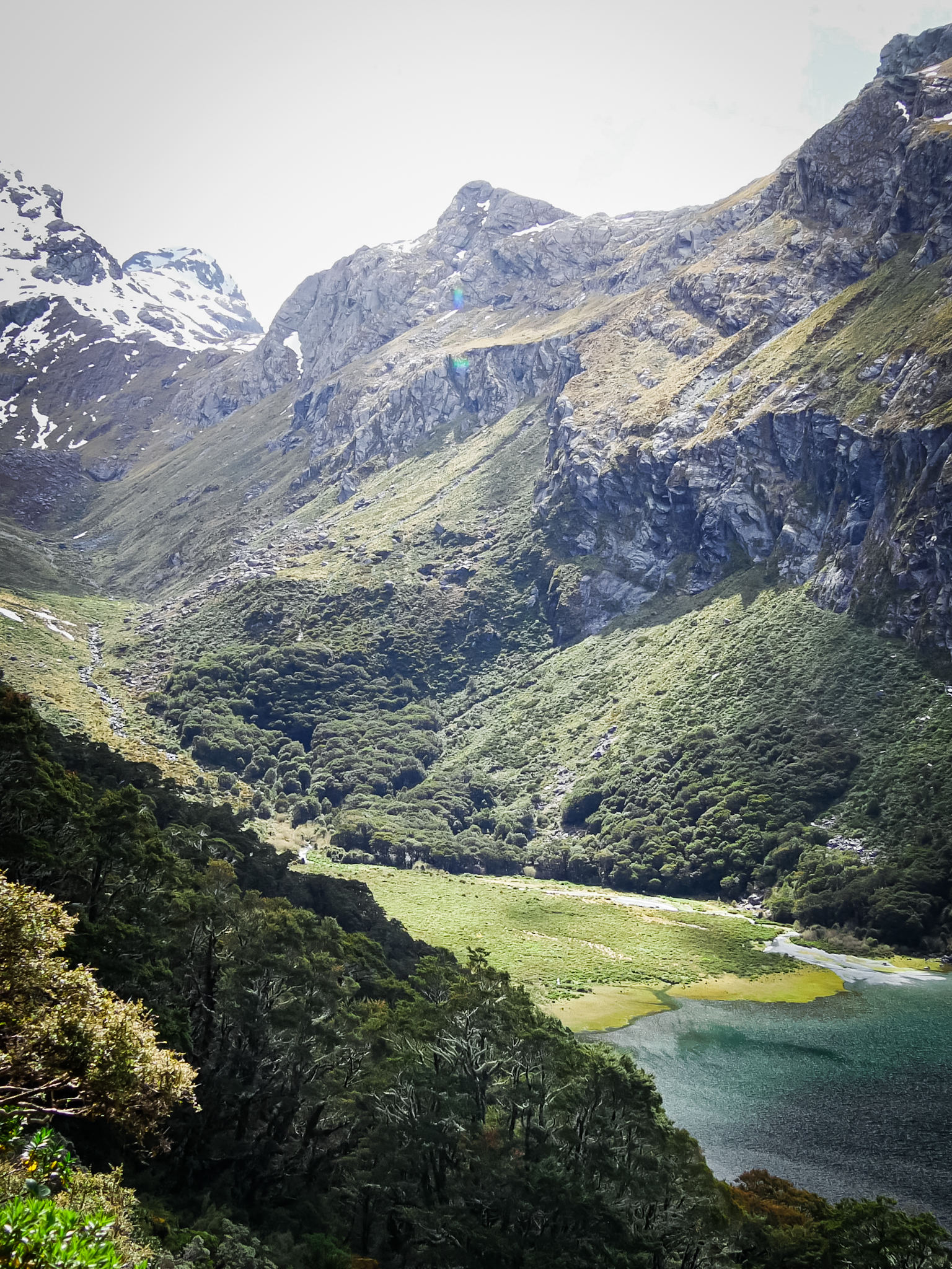
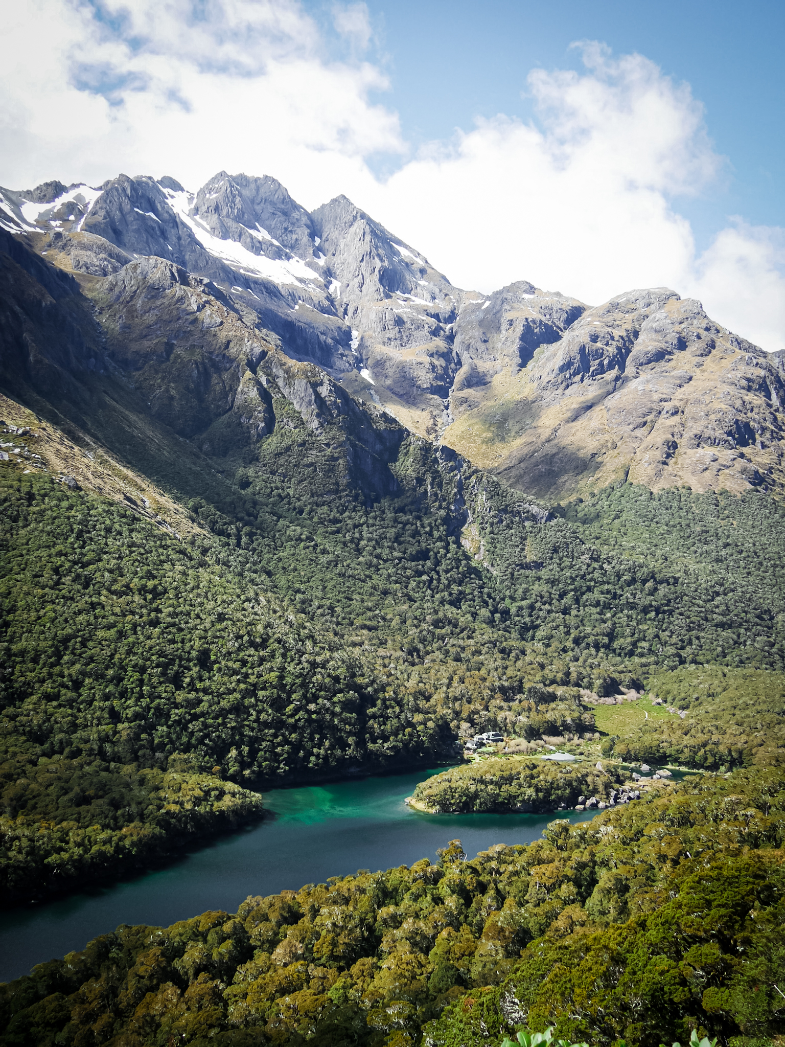
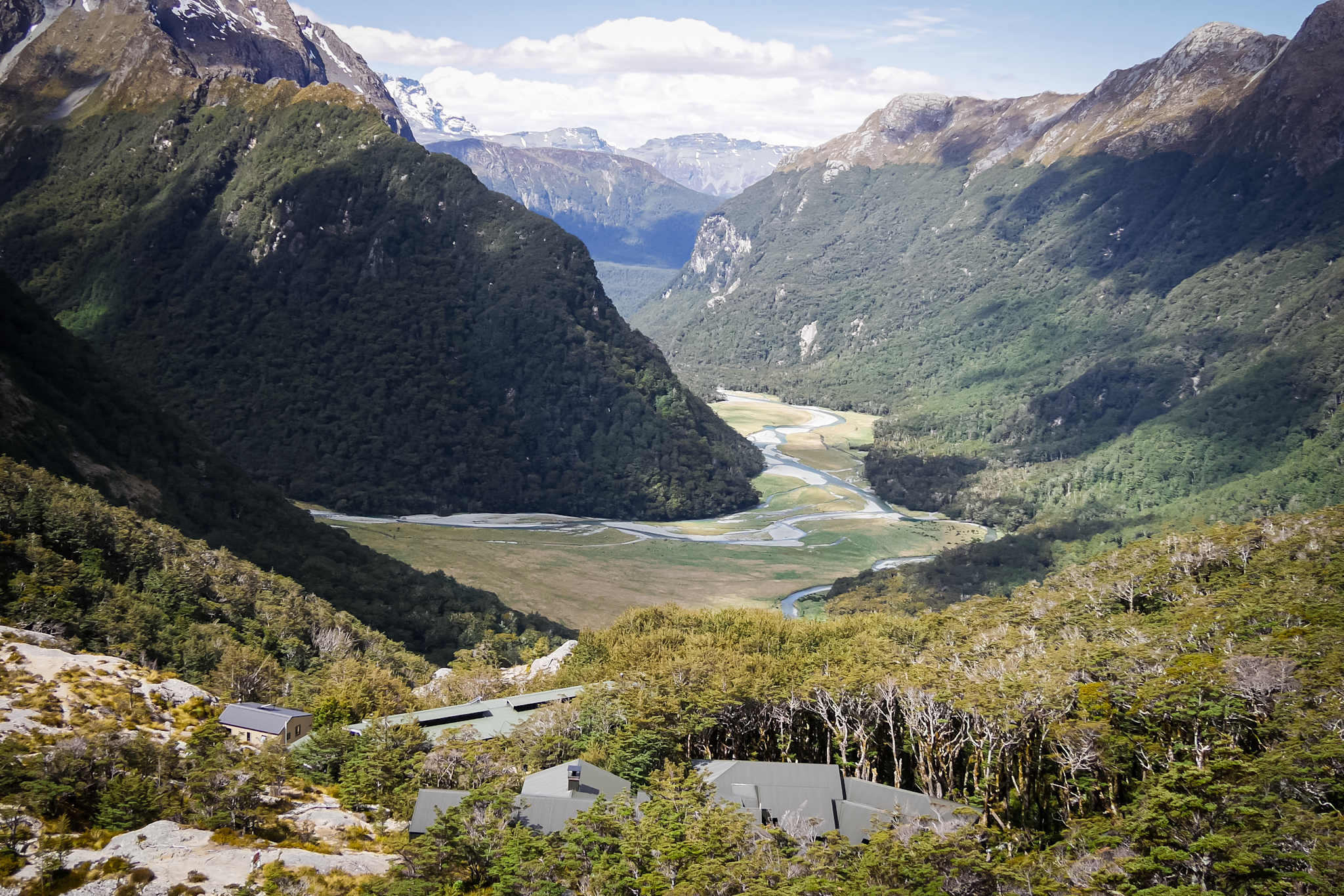
At the pass an emergency shelter awaits where most hikers stop to eat. I decide to push ten minutes further to have lunch on the shores of Lake Harris. Very good idea since it is a splendid panorama that awaits me. The lake is sumptuous, also with green-turquoise borders. I descend a little along the shores of the lake to find a location sheltered from the wind and enjoy a great break. After the meal I follow the contours of the lake then descend into the Routeburn Valley where I meet the guard of the Routeburn Falls hut working on the trail. He is finishing removing snow from the path. I pass him and continue my descent. Five minutes later, the guard catches up with me and he too, going back to the chalet, we continue the descent together. He has visited France several times and we are discussing the places he went. I finally arrive at the Routeburn Falls hutwhere a splendid view awaits me. The refuge is built on stilts directly above the valley below. The Route Burn river flows through the valley with splendid reflections.

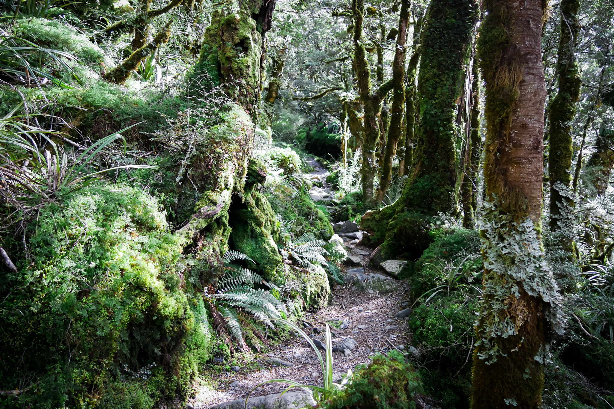
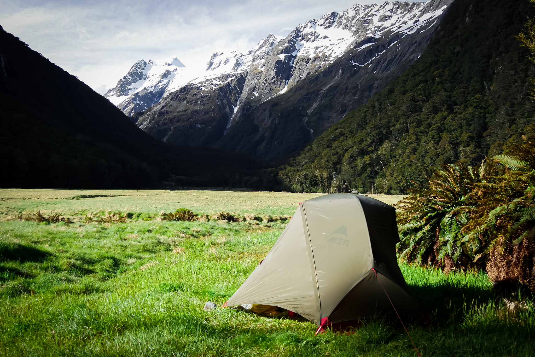
I continue my hike for another hour, descending through the beech forest to reach the bottom of the valley where the camping site is located. Unlike yesterday, no demarcated pitches but a pretty area in a meadow by the river. The view of the valley and the mountains is impressive. Absolute calm and apart from a tent already set up but with no one inside, I am the only one present. I set up my tent a bit away to be in peace. Two other tents will set up an hour after me. I aspire to see the sunset and the stars but a few clouds slowly cover the sky disturbing my expectations.

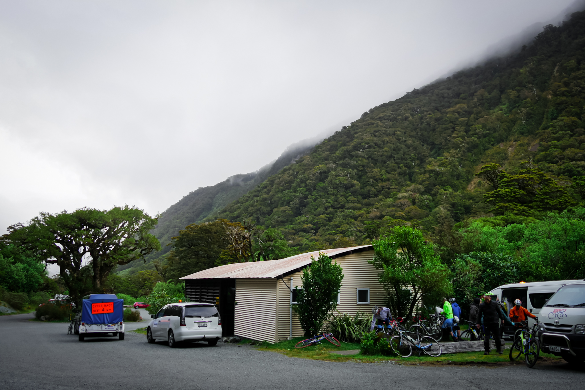
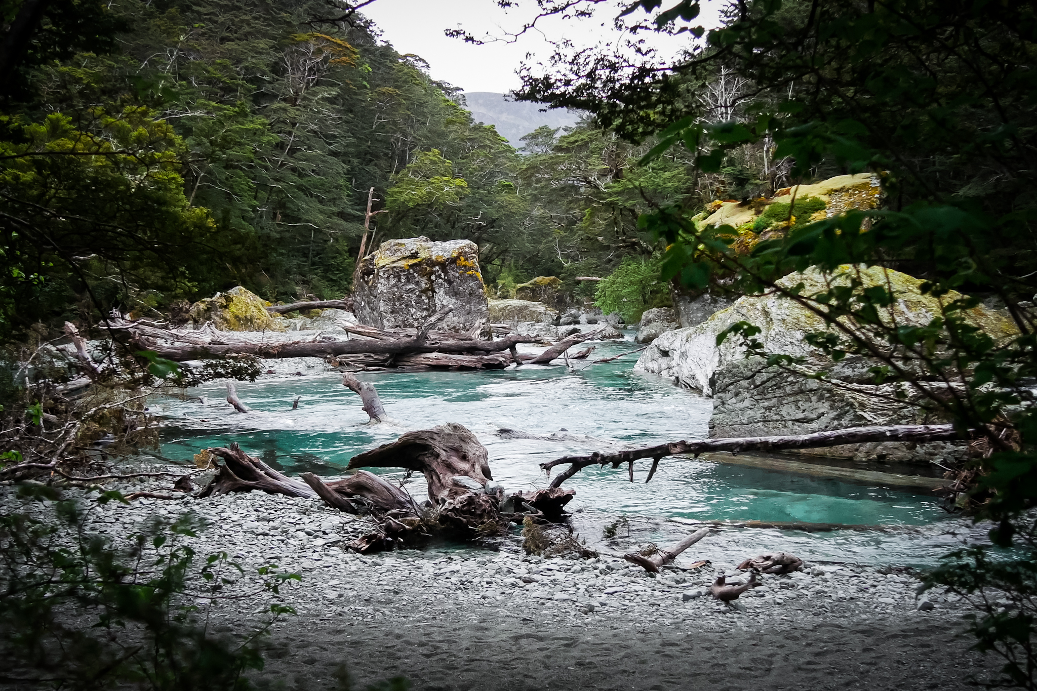
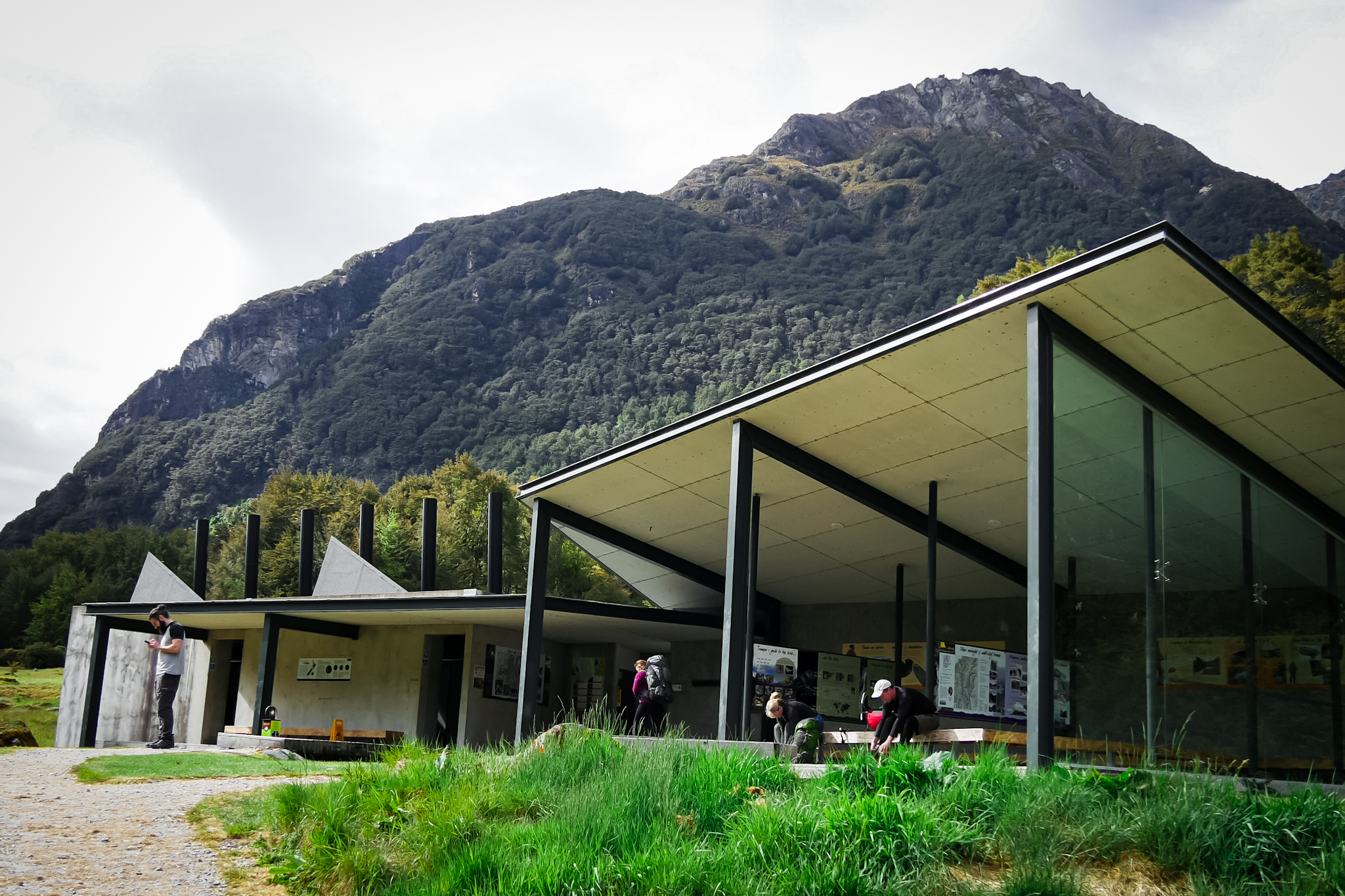
The next day I wake up around 6am under a cloudy and rainy sky. I quickly walk the last kilometers of the trail. Beech forest and green-blue waters of the Route Burn River flowing into a gorge a few meters below the trail serve as a landscape. The mist envelops the mountains and the atmosphere releases a mixture of mystery and sadness. It takes an hour and a half to reach the Routeburn Shelter, the end of the hike. A few rays pierce the veil of clouds. I wait for half an hour for the shuttle to take me to Queenstown. It arrives around 9:50 a.m. and discharges fifteen hikers ready to start walking. Unlike me, they may have bad weather. The shuttle is covered with reference to The Lord of the Rings and The Hobbit trilogies with a slogan “There and Back Again” and a license plate honoring the Ouargues (huge ferocious wolves used as mounts for Orcas in the movies).

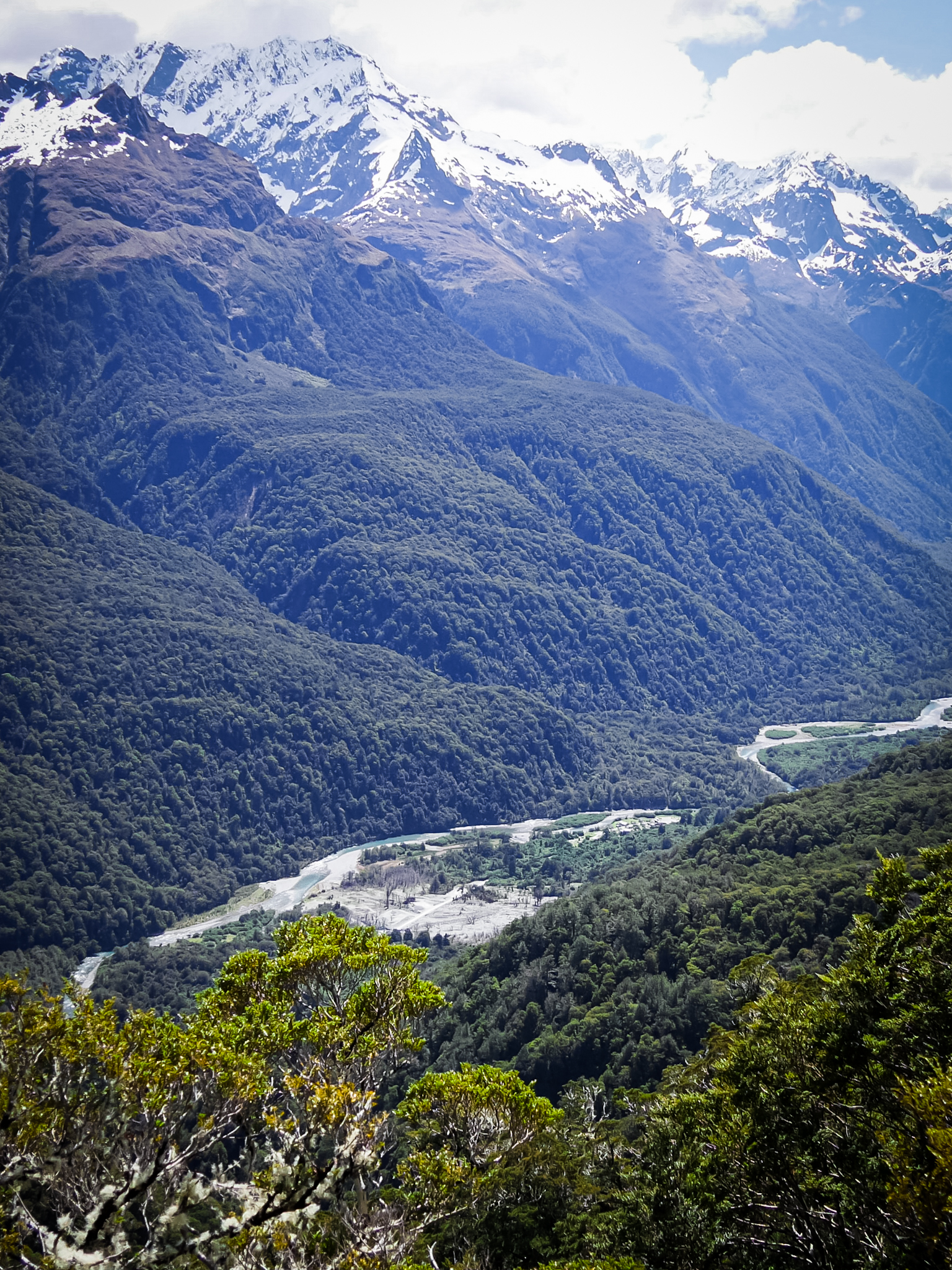
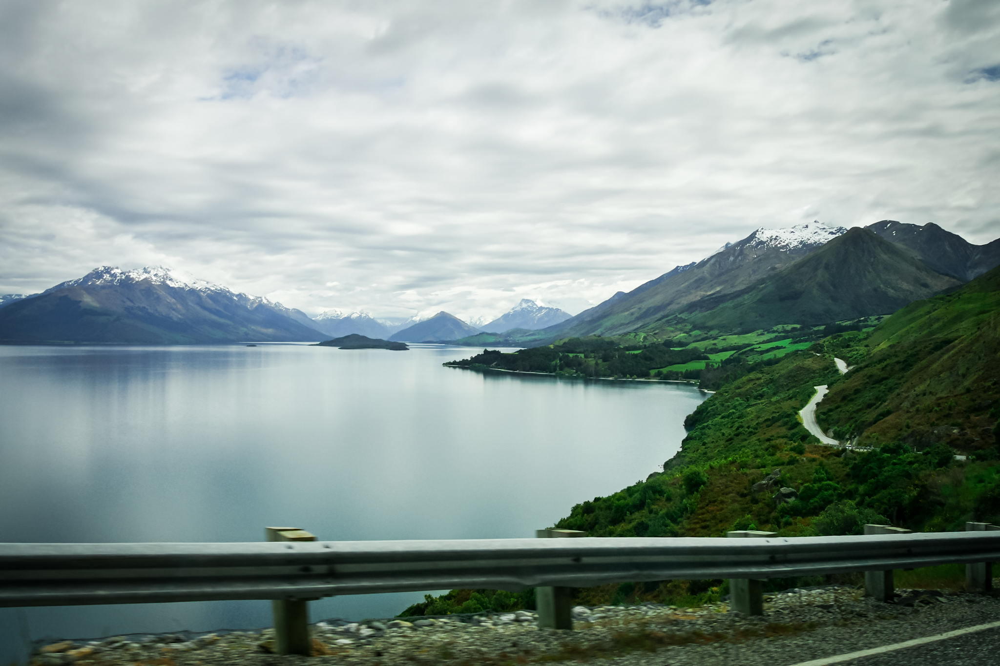
I am the only one on the shuttle. The drive to Glenorchy is breathtaking. The valley where the Dart and Rees rivers flow is surrounded by fabulous mountains and makes me think a lot of Isengard, the home of the mage Saroumane in The Lord of the Rings. And indeed! This is where the scenes for the movie were shot! I will definitely come back to spend some time in Glenorchy so that I can appreciate the surroundings in more detail. The village at the beginning of Lake Wakatipu is also surrounded by a phenomenal landscape. The second part of the journey to reach Queenstown is on the banks of Lake Wakatipu, which is extremely impressive given its length. Hot, humid weather awaits me in Queenstown. I have to wait 4:30pm to get my next bus back to Te Anau. I take this opportunity to do some shopping that I had to do for a long time (buy a helmet for my bike in particular). Queenstown hasn’t changed since the last time I came (two months ago). Always full of tourists and trendy young people.

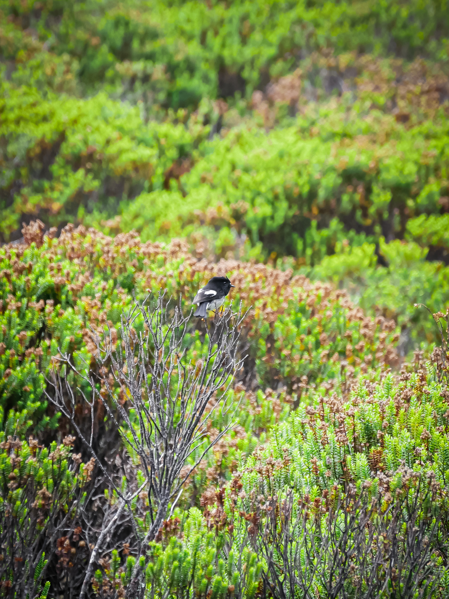
The line too long for the Fergburger (the famous best burger in the country apparently) discourages me and I fall back on empanadas. While I enjoy them quietly on a bench, a curious finch lands a few meters from me, then on my shoe, then on my knee, then on my bag, then again on my knee! He is interested in my empanadas. He flutters all around me and lands several times on my knee! It is extraordinary. I can appreciate the superb red reflections of its plumage. To thanks him, I give him a few crumbs from my meal which he greedily swallows. I spend the rest of the afternoon at the library, a torrential downpour falling on the city. I pick up the bus which drops me off at Te Anau around 7:30 in the evening, a little tired by this day spent not doing much but very happy with my hike. Although a bit short, the Routeburn Track is the most beautiful of the Great Walks in Fiordland.

Leave a Reply

Your email address will not be published. Required fields are marked *