The bus rolls through the lava fields painfully crossed on my bicycle a few days earlier. It seems so easy from the comfort of the coach. I arrive in Skogar, where the Skogafoss waterfall is still full of people. A real street lamp in the night attracting butterflies. I walk a long staircase to climb above. One kilometer away, most flip-flop-tourists have disappeared. Two kilometers further, only the irreducible remain. I am finally gone on the Laugavegur trail! Eighty kilometers to go inland and discover the center of Iceland. Or at least the beginning.
The Laugavegur trail is one of Iceland’s best-known hiking trails. It starts from Landmannalaugar, in the highlands, with its colorful mountains, to reach in about fifty kilometers Þórsmörk or “the forest of Thor”, oasis of greenery in the vastness mineral. To this is possible to add the crossing of the Fimmvörðuháls pass between the glaciers Eyjafjallajökull and Mýrdalsjökull, to reach in thirty kilometers, Skogar on the South coast. For me it will be the entirety, the eighty kilometers. And in the “opposite” direction, please, in order to avoid tourists and finish by the best part.
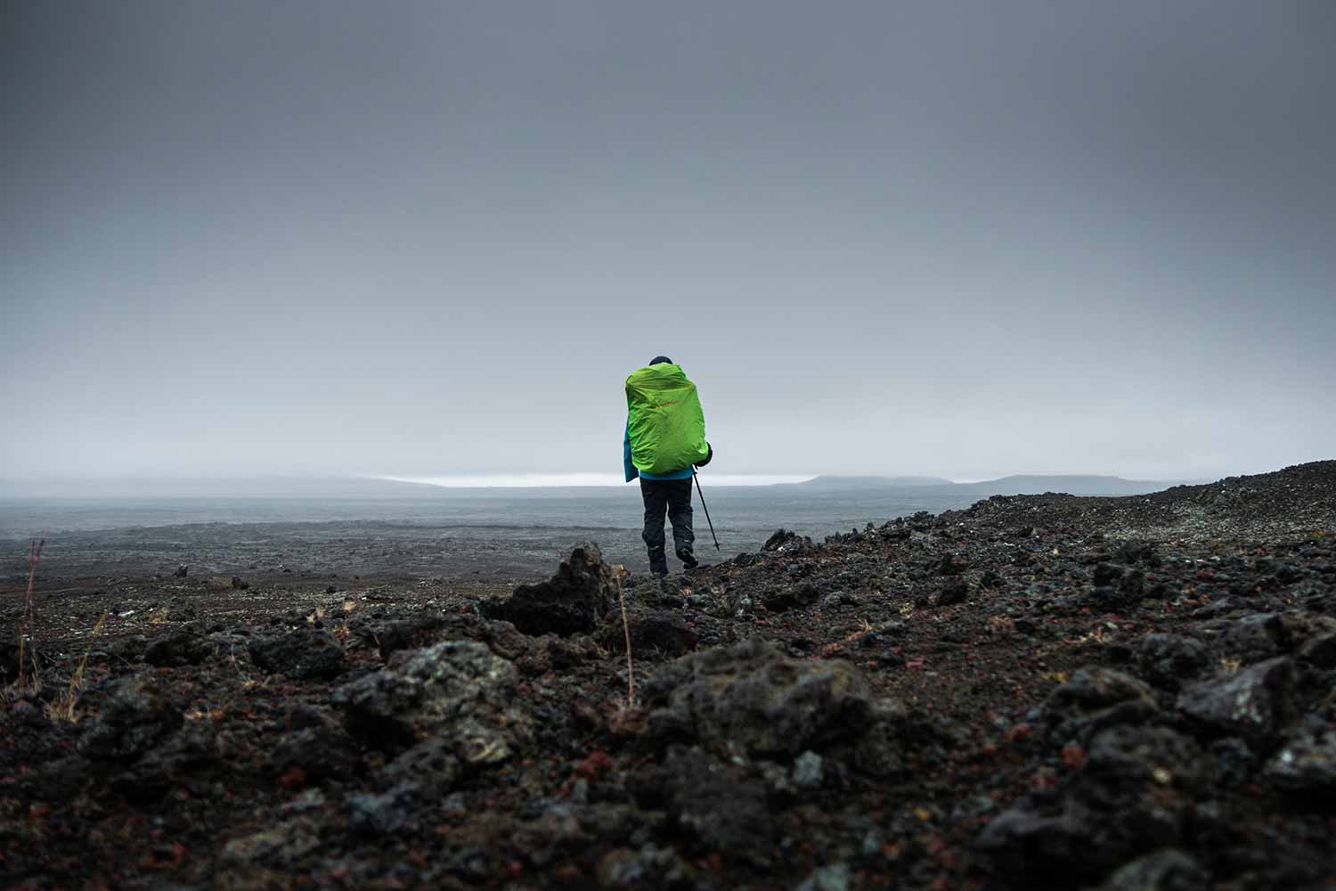
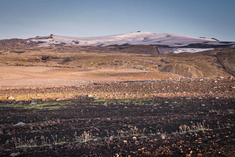
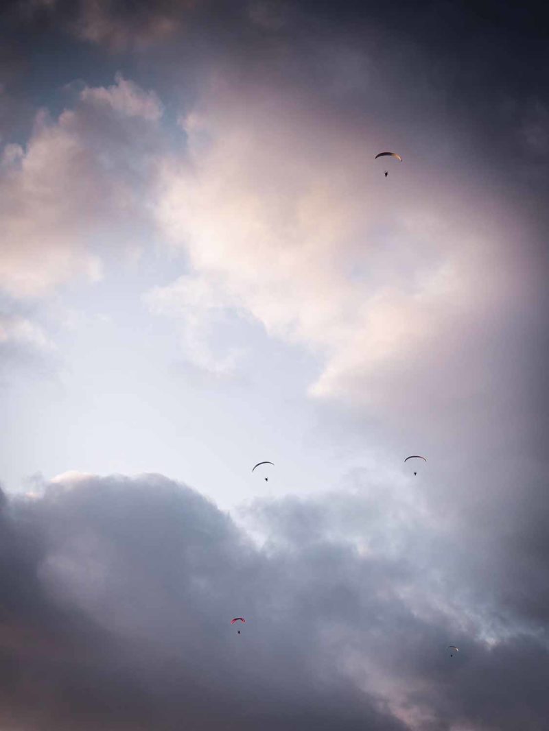
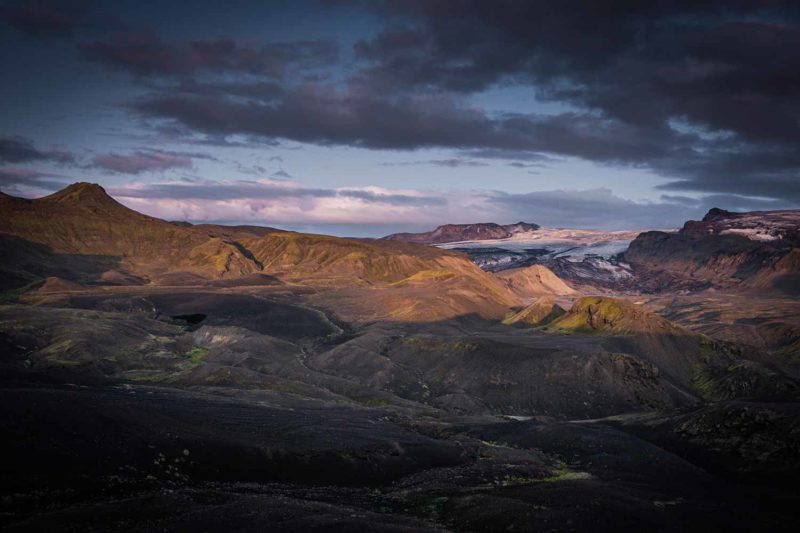
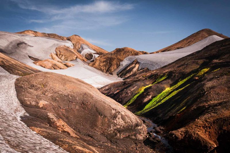
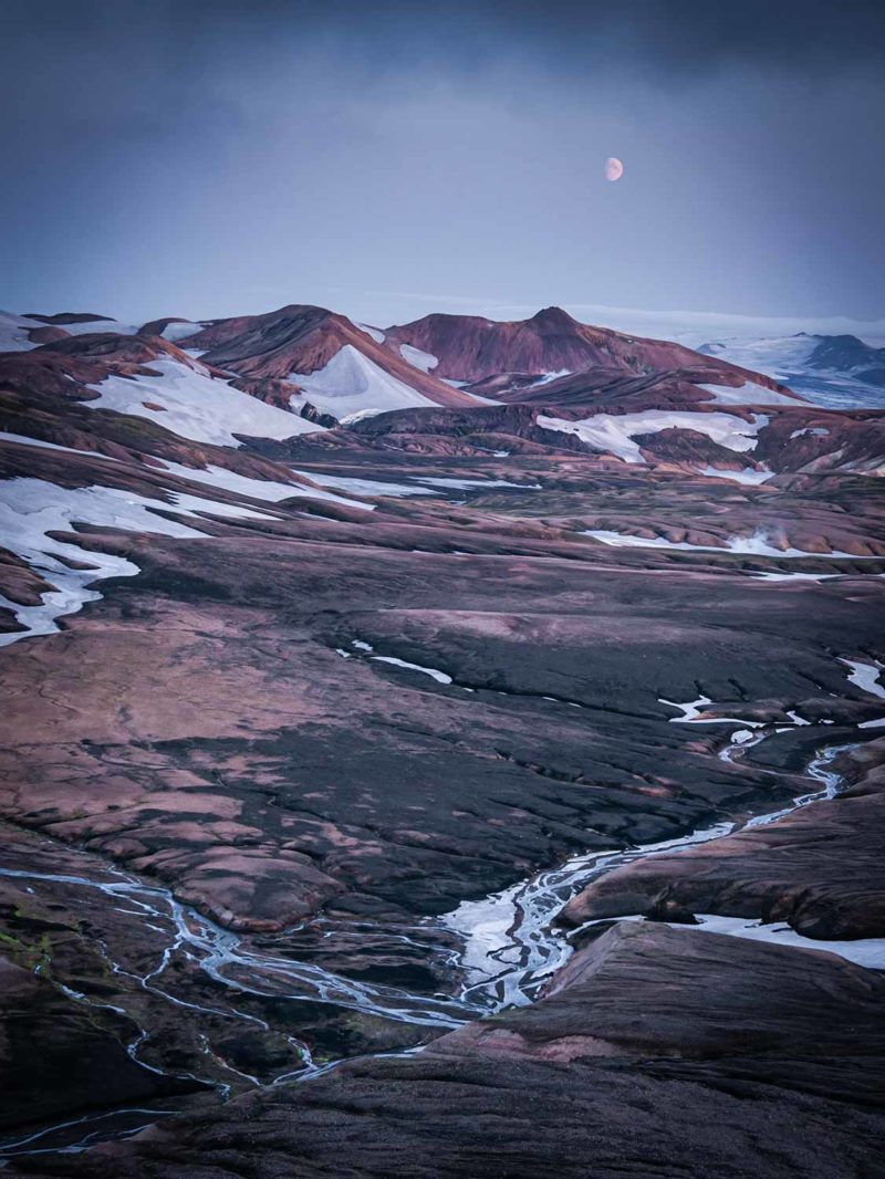
The path follows the Skoga River and its many waterfalls and then turns into a track rising through a lunar landscape. The sky is charged with black clouds but the wind blows hard moving them away from me. At the top of a small ridge, a small triangular refuge, Baldvinskali hut, awaits under a beautiful sun. On my right is the ice cap of the Eyjafjallajökull that glows in the sun. On my left is a Mýrdalsjökull tongue that appears intermittently in the mist. I camp beside the refuge, surrounding my tent with a rampart of stones. The wind does not blow very hard now, but at almost 1000 meters, I prefer to take my precautions. A motor noise comes out of nowhere and a dozen motorized paragliders appears in the sky. Was I not on the moon? They fly over the refuge in the light of a beautiful sunset and calm returns.
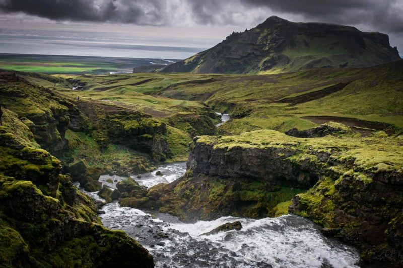
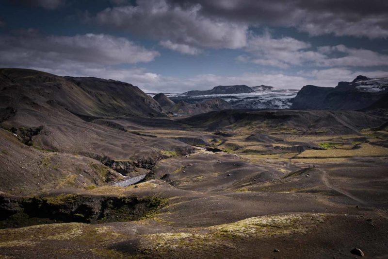
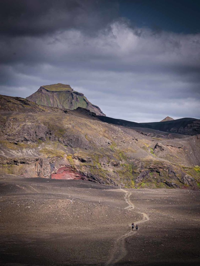
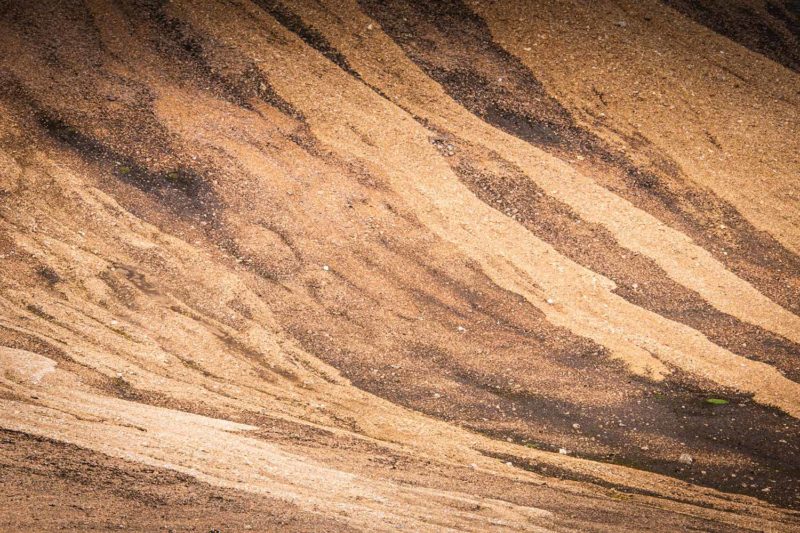
Small holes appeared on the roof of my tent. The wind was rough last night and the stones rubbed against the fabric. There were too many. I pester a little against my excess of caution but the damage is done. The path continues through volcanic screes, snowfields and desert plateaus. I reach the pass then large plateaus. Magni and Modi (whose names refer to two of Thor’s sons) stand in the middle of the path. Two outbreaks of red rocks a hundred meters high result of the Eyjafjallajokul eruption, nine years ago. The descent to Þórsmörk is long but grandiose. A large flat plateau, Morinsheidi, looks like a table put there by the hand of a facetious creator. Below, the valley covered with dwarf birches contrasts with the mineral desert of the heights. A line of small silhouettes are assaulting the mountain. They seem to be suffering, all those Sunday hikers. I am happy to go downhill. Birches, mosses, heathers and flowers. It is like being in the Alps. The abundance of vegetation due to a rainy and temperate microclimate has nothing to do with the desert landscape left a few hours ago. I spend the night at the Basar campsite along the Krossa River and then start on the Laugavegur trail towards the center.
The Kapa River is facing me. Small torrent barring the road. My first ford. I gauge the depth of the water, estimating it to about thirty centimeters. The river is divided into three small arms with beige and opaque waters. The bed is covered with pebbles. I take off my shoes, pull up my pants and start the crossing. My heart a little worried, I plunge my feet in the cold water of the first arm. The strong current and the unstable ground made of pebbles and sand make me wobble but I hold on. It is out of the question to fall into the water. I continue gently and cross the three arms without trouble. I had water up to my knees! Arrived on the other side, I laugh with relief, satisfied to have crossed my first ford. There will be others.
The landscape changes with the rhythm of the kilometers passing. Black volcanic blocks follow a moor of heather with pink flowers. Desert valleys give way to big canyons. A line of walkers in the opposite direction of mine disturbs the silence for a few hours before fading into the distance. I walk in a more austere landscape, my legs a little tired by the long descent yesterday from the Fimmvörðuháls pass. I camp at the Botnar refuge and campsite, on a small plateau, surrounded by hundred tents. The circus, even in the heart of nature.
The Skoga river on the left and on the right, the plateau of the Fimmvörðuháls pass.
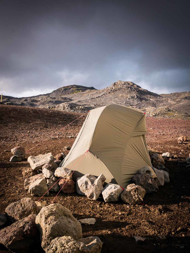
Bivouac at the pass.
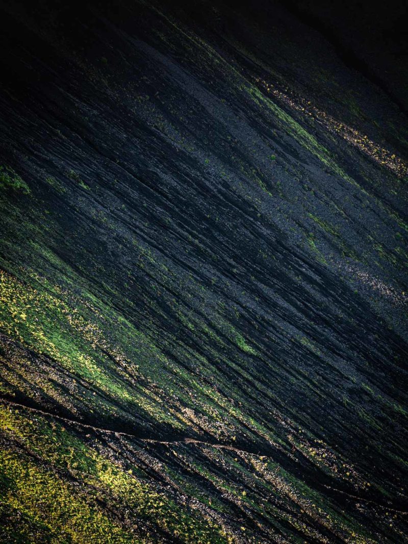
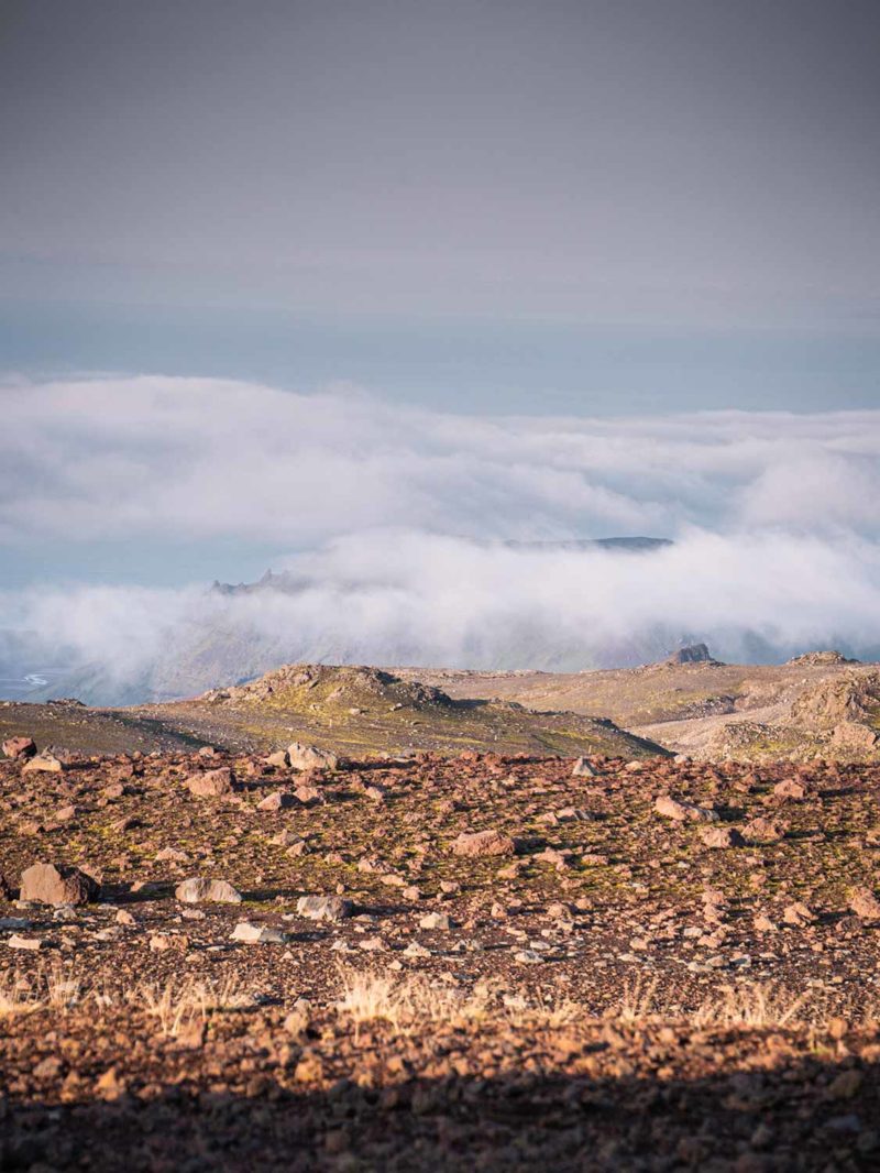
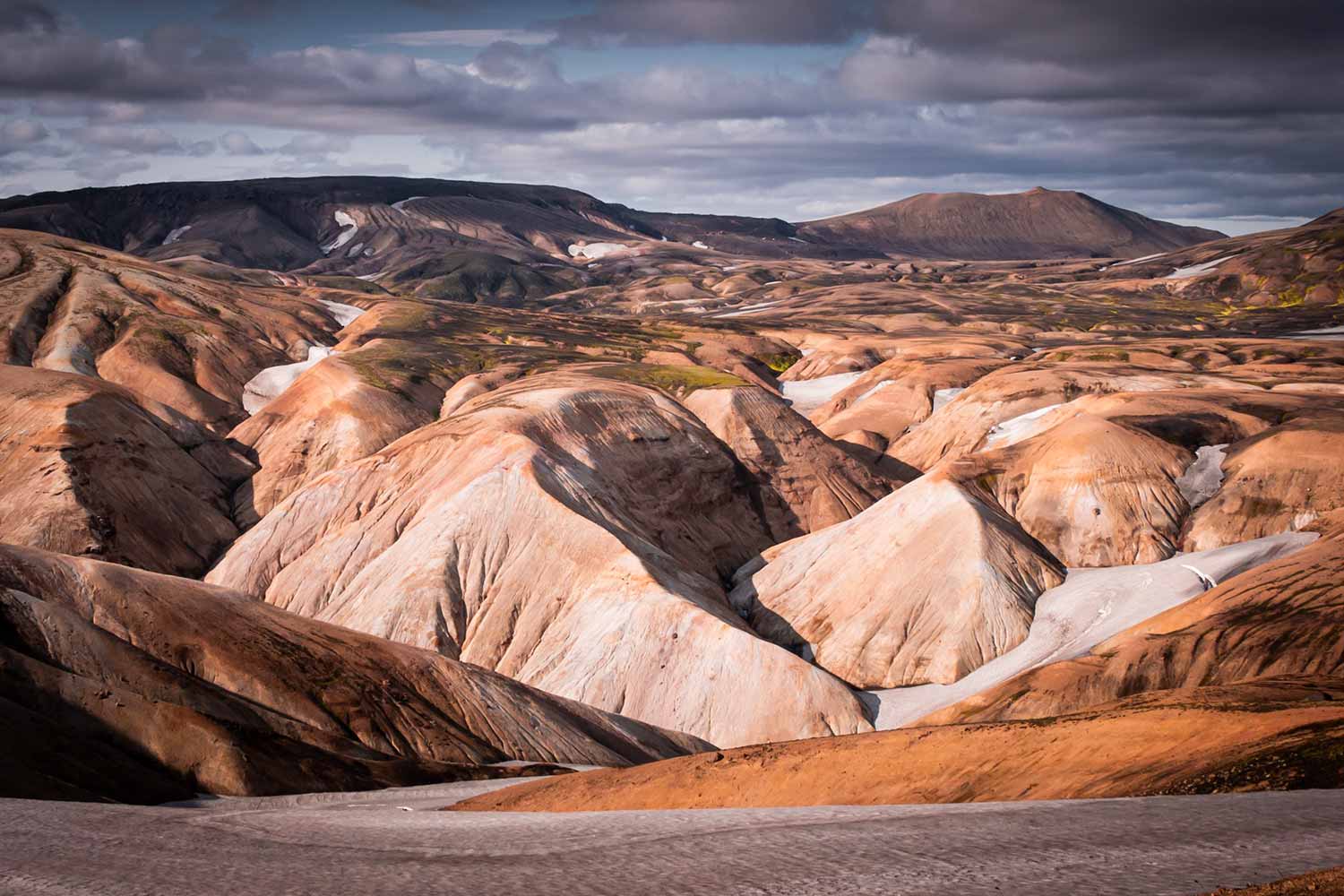
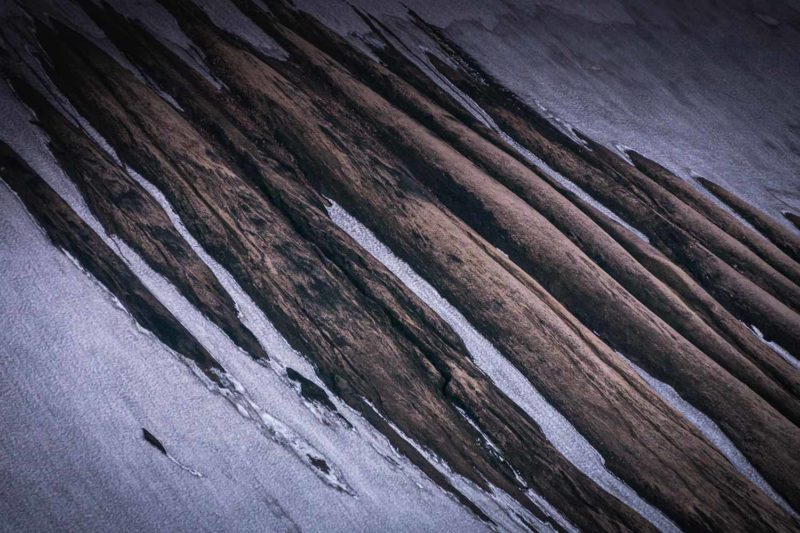
The magnificent desert landscapes.
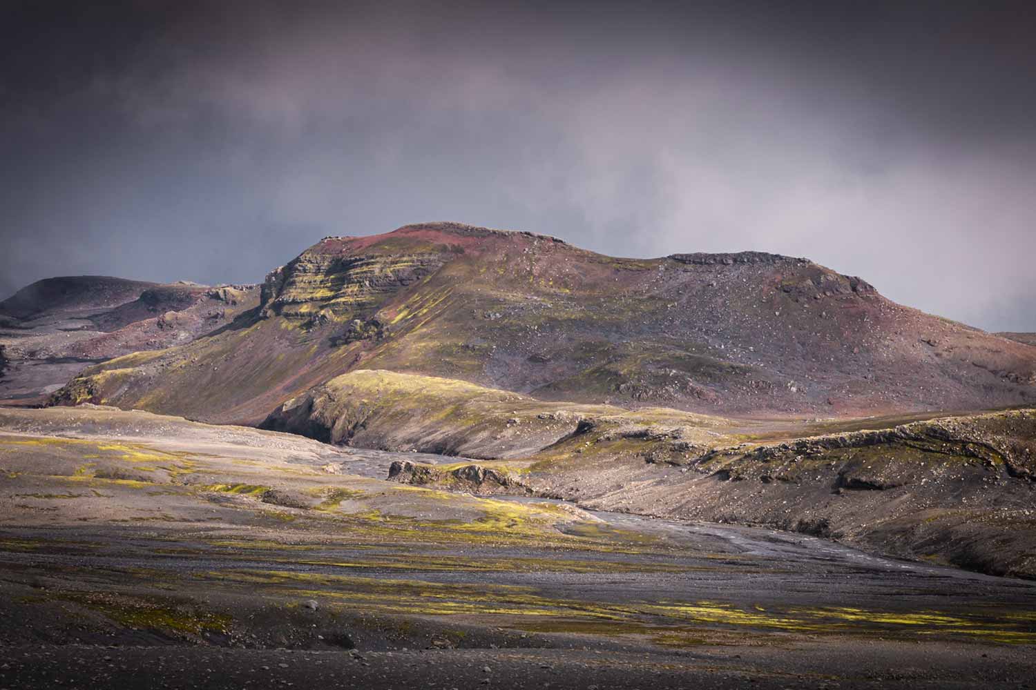
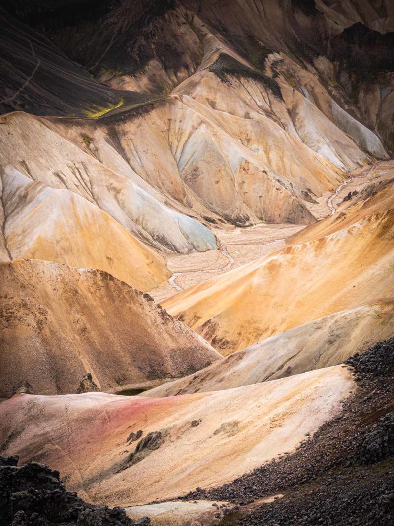
Third day on the trail. A great mineral desert stretches for miles. It is headwind. Large mountains covered with green moss contrast with the desert black soil. It appears naked, sterile, but only for those who do not know how to look. Heaps of small flowers and mosses hide behind each rock. The environment is tough but not for everyone. I pass the second ford easily, then the Hvanngil hut nestled in a valley covered with grass and reach the great lake Alftavatn shining in the sun. A shelter and camping are located on its shore. But the wind makes the tents wobble. It is only 1pm and I feel in good shape. I did fifteen kilometers and decide to go for a dozen more towards the Hrafntinnusker hut, located 500 meters higher.
The wind has strengthened and the climb to the pass is impressive. The path is steep and very eroded. I thank the chance I have to get a great sunny day. In rainy weather, the passage must be very difficult. At the top, I discover mountains with yellow-orange colors and geothermal zones. It smokes in places with a sweet smell characteristic of rotten egg. Pink, yellow, green and blue colors dot the landscape. I am amazed. Despite the biting cold air I take my time to cross the mountains. Further, a large plateau stretches to announce an easy progression but as it is often the case in Iceland, it is misleading. Small crevices with streams and snowfields dot the plateau, making progression slow and difficult. I see Hrafntinnusker hut, a touch of red in the distance. The last four kilometers are long and difficult, my legs slowly giving up. But boy it is beautiful! The most beautiful part of the hike. I really feel like walking on the moon. Or on Mars. I finally arrive at the shelter, frozen and quite tired. The space to camp is in the wind. I try my luck asking if there is a bed left in the shelter. And luck smiles on me. Two beds are still available and despite the very expensive price, I surrender to comfort. The refuge is not very big and crowded but at least it is hot. Almost too hot. Sunset illuminates in pink the landscapes so different. My heart is happy. Happy to have managed to walk twenty-seven kilometers, happy with the beautiful weather and happy with the magnificence of the landscape.
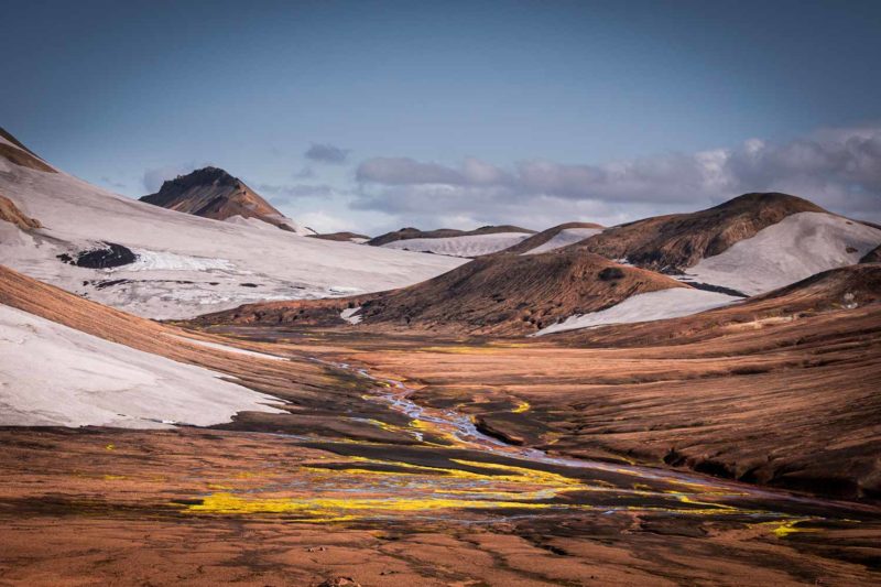
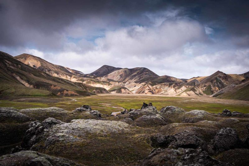
It was hot in the shelter during the night. I did not sleep very well. But the mist has invaded the landscape and the wind is unleashed outside. I equip myself as best as possible and commit to my last twelve kilometers, leaving behind the heat of the refuge. It is the great silence between the gusts of wind. I am pretty cold. It must be only a few degrees. From a hole in the ground springs boiling water. The smoke envelops the path. I dive a finger in the little stream flowing beside. The water is hot, very hot. I almost want to immerse myself completely to escape the biting cold. The mountains of Landmannalaugar eventually appear as the sky is covered with clouds laden with rain. This is not the explosion of colors I expected. The mountains range from yellow, to orange, to pink and green. But it is somewhat faded. In the valley, a large lava flow, the Laugahraun stretches surprisingly. Entirely made of obsidian, the black color of the flow contrasts with the surrounding mountains. A feeling of satisfaction tinged with a touch of disappointment strides through my mind.
The crowd of tourists is back. Everyone looks at me with a weird look. Have they never seen someone hiking with a big backpack and a tent? Or it is the fact that I go downhill? It does not matter. I cross the lava field and here I am back to civilization. A little too early for my taste. It is noon and I decide to take the 2.30pm bus back to the coast. The gray weather and the return to the crowd of tourists have cut my legs and motivation. A hot soup in a small bus converted into a “restaurant” makes me feel better. Outside the gusts make people waver. In the bus-truck bumping on the pebbles of the track that brings me back to Hella on the south coast, I dive in a pensive mood. I do not want to go back to this south coast. The words of a cyclist I met earlier come to my mind. “Go on the tracks of the center, you will not regret it. There are fewer people and the landscape is superb, you will not be disappointed, you’ll see!” So, already dreaming of finding back these so different landscapes and motivated by the announcement of a mild weather, I to decide drop the continuation of the South coast to return to the Highlands.
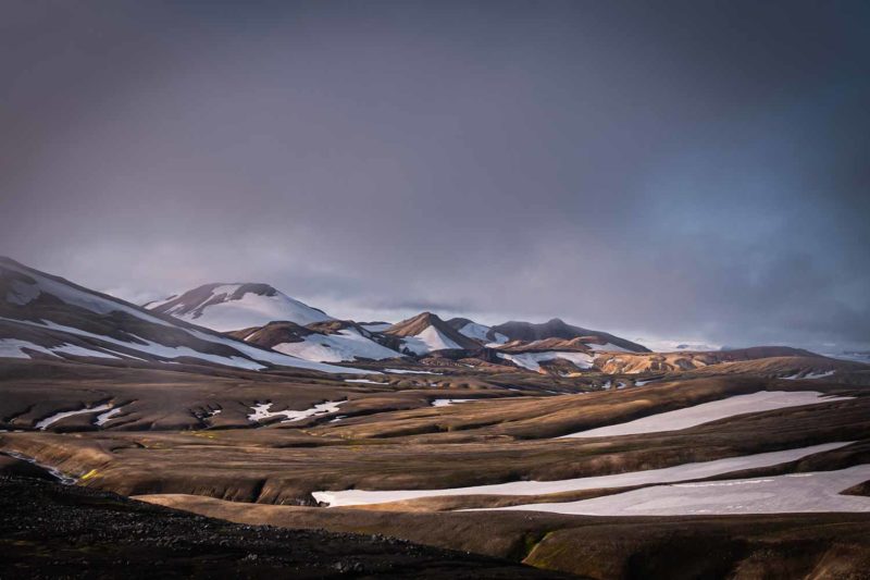
The fantastic colors of the Hrafntinnusker plateau.
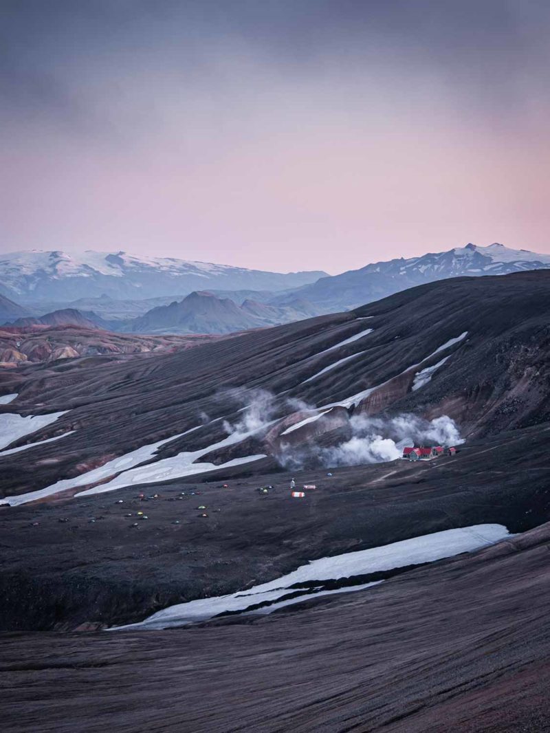
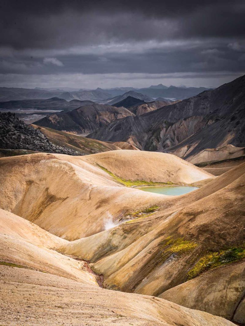
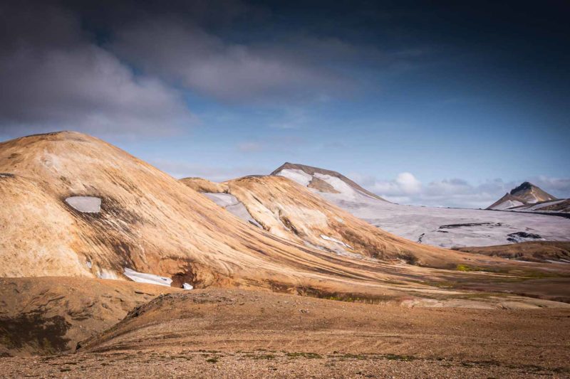
On the left, the Hrafntinnusker camp and refuge. And right, the colorful mountains of Landmannalaugar.
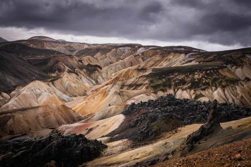
On the right, the Laugahraun lava flow.