Day 1: Along the coast
I wake up on a cloudy day at the Flodigarry Hostel Campsite where I arrived last night after taking the ferry from the Outer Hebrides. The tiny village is located along the North Skye Coast on the Trotternish Peninsula, the largest peninsula in Skye and one of the prettiest. After four weeks of hiking, I am a little bit tired. In addition, I did not have time to prepare much for my stay on Skye. I bought a card last night and that’s it. I had thought of doing the Skye Trail, a seven-day trek of about 130km across the Skye peninsulas, but my limited time and the hiking difficulty (a bit higher physically than the West Highland Way and the Hebridean Way and apparently very little marked) have slowed me a bit. Looking at the short detailed hikes in the hostel reception and on the advice of a Belgian couple, I have decided to go for a walk along the coast, on the Quiraing, along the Old Man of Storr and through the Glen Sligachan in the start of the Cuillin on the south coast of Skye. Here is the plan. Four days. Four hikes.
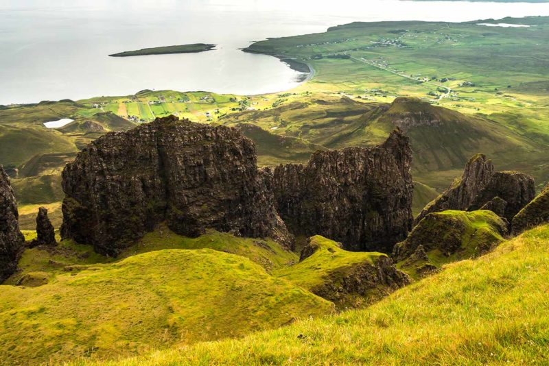
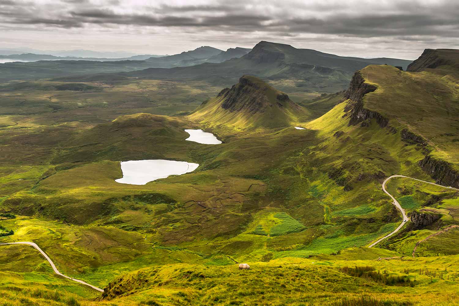
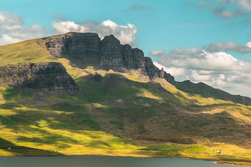
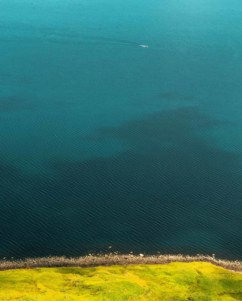
An t-Eilean Sgitheanach, of its Gaelic name is the largest and most northern island of the Inner Hebrides archipelago on the west coast of Scotland. Renowned for its volcanic mountain landscape with the Cuillin Mountains and Trotternish Ridge, the island attracts tourists looking for adventure. I start my day by the Coastal Path, a path along the coast from the hostel to Duntulm about fifteen kilometers where are the ruins of an old castle. The clouds are clearing and I leave the beach under a nice sun. I marvel at the landscape and the edentate coast. Skye is green. The Hebrides were bathed in yellow tones, Skye appears green and much colder. I feel like I am back in the Highlands, which is true since Skye is part of the Highland region. I walk along the cliffs which although not very high do not remain less impressive. The path runs along the edge sometimes very closely and I feel almost dizzy. Inland, an impressive massif fascinates me. It is the Quiraing, a geological formation of volcanic origin and north end of the Trotternish Ridge, a large thirty kilometers landslide running in the center of the peninsula. High cliffs come out of the earth to form a massive wall overhung by a long plateau.
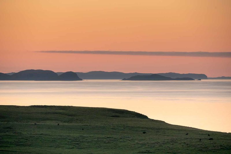
Around noon, I arrive at Rubba Hunish, the northernmost point of Skye where there is a lookout. I distinguish a small building that turns out to be a little refuge or Bothy as the Scots call it! This is the first I have seen one since I arrived in Scotland. Inside, two beds, a few seats and books and a small “veranda” to enjoy the view. In the distance spread out the Outer Hebrides where I was yesterday. I have lunch inside protected from the wind and take the opportunity to learn more about the Scottish Bothy. Listed on the website Mountainbothies it turns out that there are simple small shelters like the one where I am all over Scotland and the rest of the UK but mainly in national parks. There is only one on the Outer Hebrides and only four on Skye. They are usually located in rather isolated places. I also realize that the Coastal Path is actually the first day of the Skye Trail! But in the other direction. The path starts at Rubba Hunish to finish its first day at Flodigarry. As I continue to study the way, I realize that all the hikes I chose to do are part of the Skye Trail! Lucky me!
I continue along the coast and arrive at the remains of the small castle perched on a mound by the sea. Built in the 14th century by the clan MacDonald, one of the largest Scottish clans, it was abandoned in 1732 and its stones were recovered to build other residences. Today only a few stones remain, a ban on entering the interior and a crowd of tourists. Back on the road I hitchhike back to the other direction to join Brother’s point, a small headland after the village of Staffin where I decided to go for a walk to conclude the day.
A lady takes me hitchhiking but she stops at Kilt Rock, one of the most touristy places in Skye, just before Brother’s Point. I go take a look but it is filled again with a crowd of tourists which do not enchant me. The cliff is supposed to look like a “kilt” and a 60m waterfall, Mealt Waterfall jets into the sea. Several dinosaur footprints have also been found in the area. I do not stay long and continue a little on the road before being able to get hitched to finally reach Brother’s Point. Apparently a congregation would have lived in the corner, hence the name of the place. The area is nice, a small advance of land with strange shapes in the sea. Then I need more than forty minutes before being able to get hitchhiked to return to Flodigarry. A little bit too long. Fortunately, a very nice couple of Germans finally collect me and I return to Flodigarry. The young woman comes to Skye regularly and we discuss the effects of tourism on the island. She tells me that in seven years, tourism has exploded and is coming from everywhere: Germans, French, Americans, Latinos, Chinese, etc. Indeed, Skye is much more touristy than the Outer Hebrides and small country roads are now permanently congested with large motorhomes or bus tours. I regret the loss of the calm and wild side of the island.
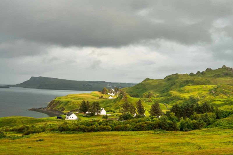
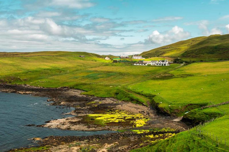
Along the coast with the village of Flodigarry at the top left and the hamlet of Duntulm at the bottom right.
Day 2: Walking the Quiraing
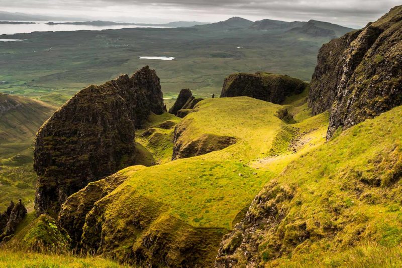
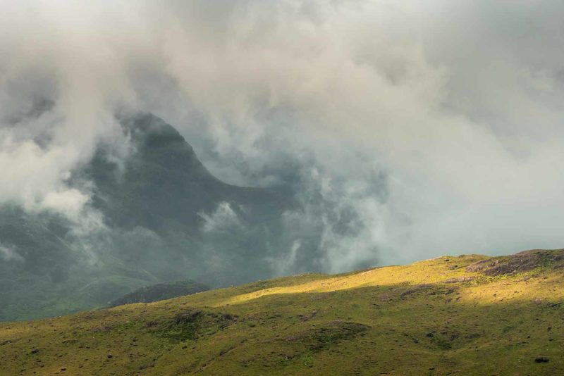
Today I am attacking the Quiraing, this particular mass that obsessed me a lot yesterday. I leave the hostel and follow the trail of the Skye Trail second day. This second day is normally thirty kilometers long and crosses the Quiraing massif and then Trotternish Ridge to Old Man of Storr on the other side of the peninsula. Most people cut the journey in half and sleep on the ridge. I would have loved to do it but I didn’t prepared anything so it is too late. I regret a little but it is like that.
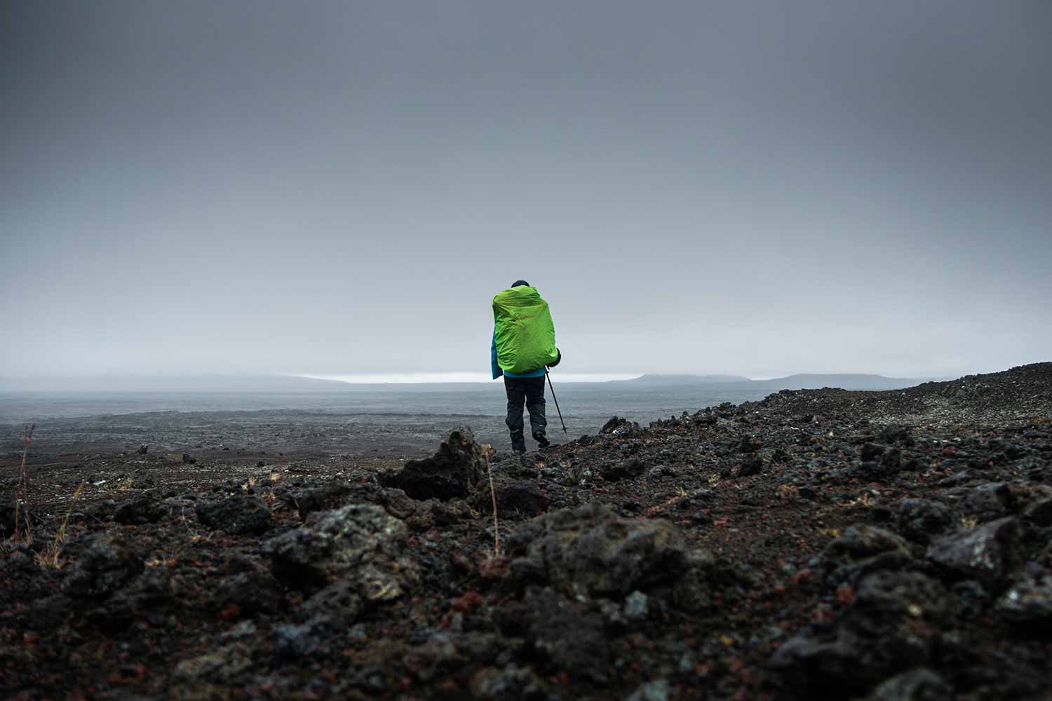
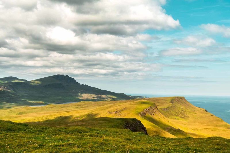
I walk along the road and on a trail up through the hills. It is cloudy but the cliffs and green hills are impressive. I climb through the volcanic formations fascinated by the landscape. As it is still early there are not many people, it is perfect. The place being very busy, I have only a few hours of respite before the horde arrive. I climb on the plateau above and I feel like in Iceland. Or what I imagine of Iceland. Large volcanic hills with strange shapes all at once coming out of the land near the sea… I appreciate the more mountainous side of Skye that I missed a little on the Hebrides. The view from the top is fabulous and I discover “The Table”, a kind of small plateau hidden and difficult to access, protected by walls of stones. In front of me spread the Trotternish Ridge and I really regret of not being gone for the whole crossing. The hike along the ridge looks sublime, although very physical, and spending the night in bivouac must be quite exceptional. Well, there is only one thing left to do: come back. Return to Skye (and Scotland) and do the Skye Trail.
I go down the other side of the Quiraing where a small road separating the two massifs collapses under tourist cars. The horde has arrived and the calm has disappeared. I buy a vegetarian burger prepared by a lady with strong Russian accents that inform me that the situation of tourism on Skye is a disaster. Indeed, looking at the permanent traffic jam that spreads before my eyes, I agree. Tourism explodes but infrastructure does not follow. In just a few years, Skye hills have been stormed by tourists who are not hikers and who are ecologically and environmentally unconscious. And little is put in place by councils and politicians to try to fix things.
I watch the endless stream of noisy tourists who can not watch the landscape, obsessed with their mobile phone and trying to get the ultimate photo to post on Instagram and it pisses me off a bit. What a pity that these beautiful places are today reduced to mere tourist attractions. If I have the opportunity to return to Skye, what I really hope, I will return in Autumn, largely less touristy season to enjoy the quiet atmosphere of the place. I return to Flodigarry making a loop and skirting this time the cliffs of the massif. The sun has appeared and it is hot. I join the campsite and enjoy a beautiful sunset to conclude a beautiful day of hiking (despite the flood of tourists).
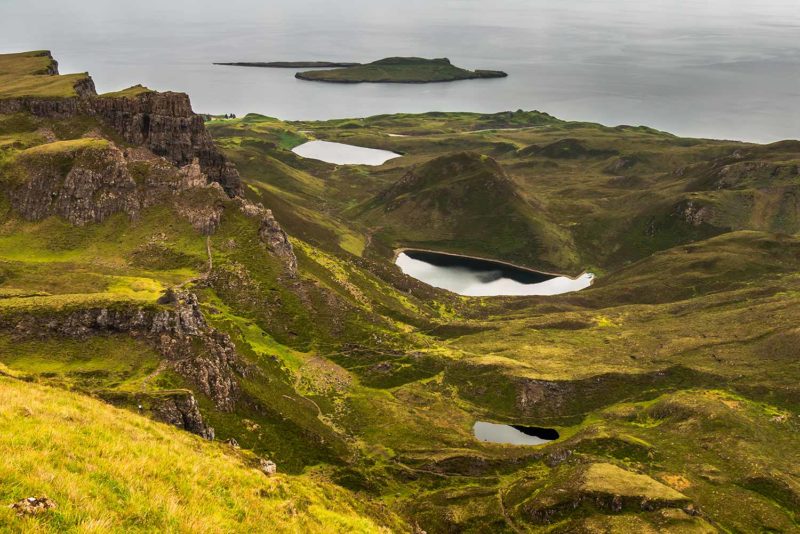
The Quiraing massif. Below “The Table” on the Quiraing.
The Trotternish Ridge from the Quiraing.
Day 3: Skye, the beautiful
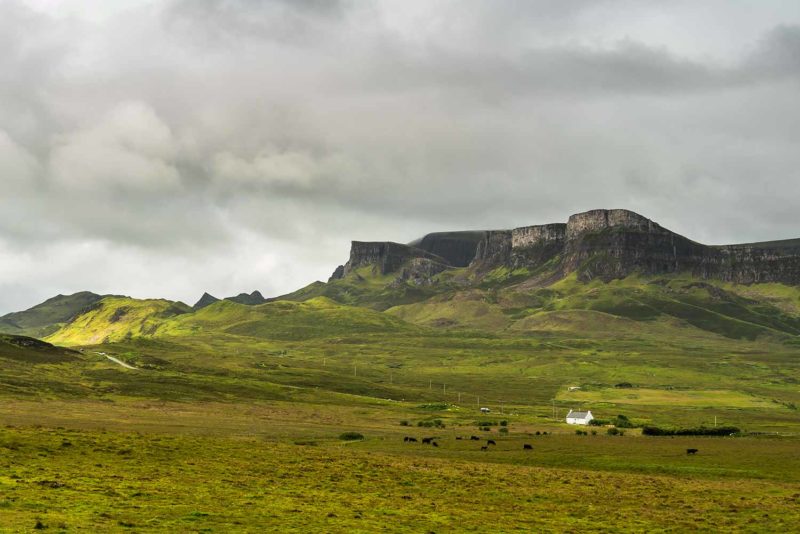
The bus drops me at 8:30am at the parking along the road to join The Old Man of Storr. It is already full of people. The Old Man of Storr is a 55 meter high monolith at the southern end of Trotternish Ridge. The rock formed after the erosion of The Storr Hill and this is where the second day of the Skye Trail ends. It is also one of the most iconic sights in Skye, so it is a tourist magnet.
I have decided to go see the rock and then go down and continue along the coast to reach Portree, along the Skye Trail and its third day. I walk along a path that looks like a boulevard surrounded by cut trees. There are only trunks left and that is very ugly. A bit higher The Storr appears with the Old Man of Storr and The Needle Rock (a long thin rock with two holes in the center) in the foreground. People are squealing and a drone flying over the massif makes an annoying noise. Nevertheless, I am blown away by the beauty of the landscape. It is impressive. In front of me, the coast spreads and I distinguish the cliffs that I will follow soon. Behind me, I can see the trail down the Trotternish Ridge. A pinch of disappointment still tickles my heart. I really have to come back.
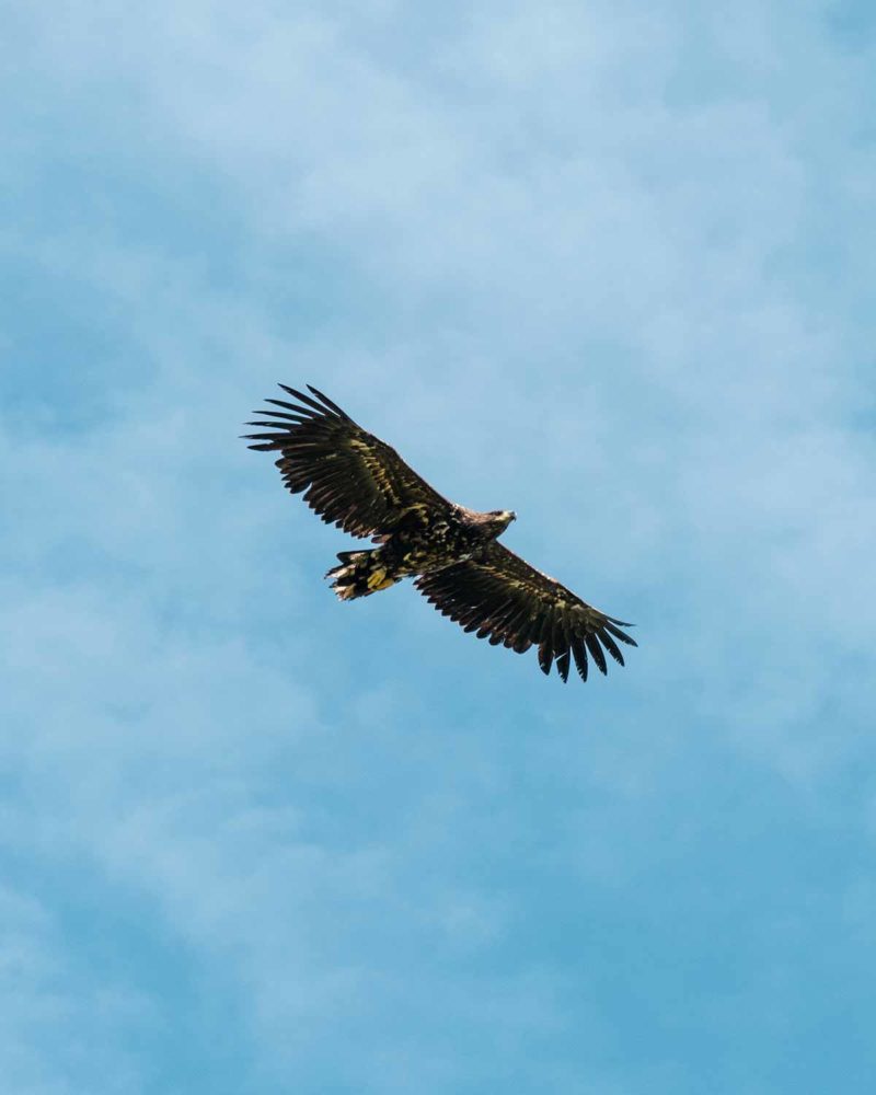
I go down and continue along the coast. There are a lot less people on that side. It is very nice. I go see the beautiful Bearreraig Bay where were also found dinosaur footprints and I continue along three kilometers in peat bogs. I finally arrive at the cliffs ridge under a blazing sun. I have lunch enjoying the magnificent view. On one side the Trottrenish Ridge, on the other the island of Raasay and the Cuillin (a large mountain range on the southern peninsula of Skye). Sleeping in the grass, I suddenly feel a gigantic shadow. A golden eagle I think, flies over me a few meters above! He is magnificent. For a good five minutes, he is flying over me circling in the air. I can see his yellow paws and I am ecstatic at the size of the bird. He flies away and I continue my way, beautiful, along the small ridge.
In Portree, I refresh my feet in the sea. It is very hot and I feel a little flat. In the small town, center of Skye, I buy a book detailing the Skye Trail and a very good homemade ice cream chocolate-banofee that I eat on the small harbor with colorful houses. I buy some groceries for the next days then take the bus to return to Flodigarry, exhausted but very happy with my day.
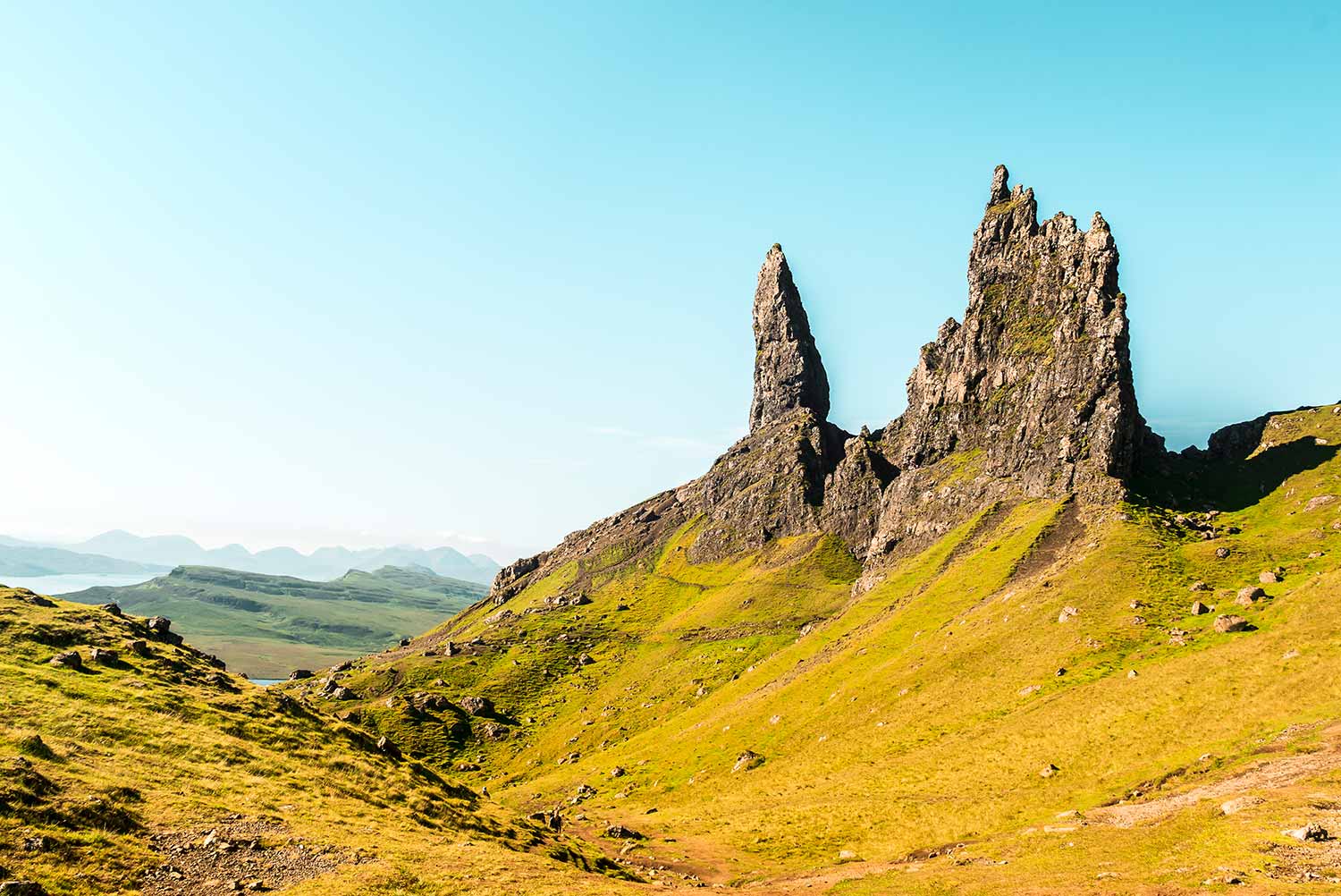
The Old Man of Storr and The Needle Rock.
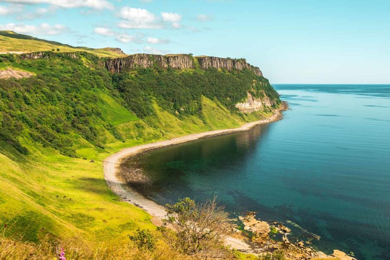
Bearreraig Bay and the Trotternish Ridge with The Old Man of Storr.
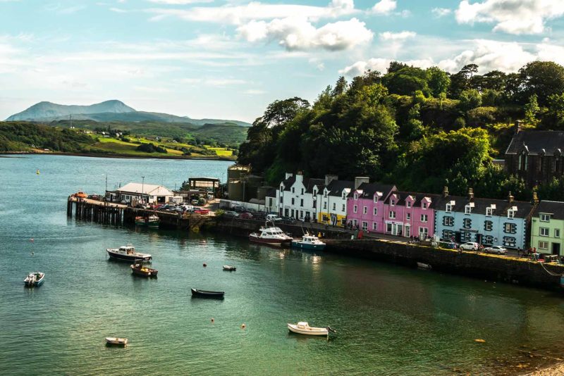
The west coast and the town of Portree.
Day 4: A glimpse of the Cuillin
I leave Flodigarry definitely this time to reach Sligachan south of Skye where begins the Cuillin massif. I am gonna follow the fifth day of the Skye Trail through Glen Sligachan, a valley separating the Red and Black Cuillin ranges.
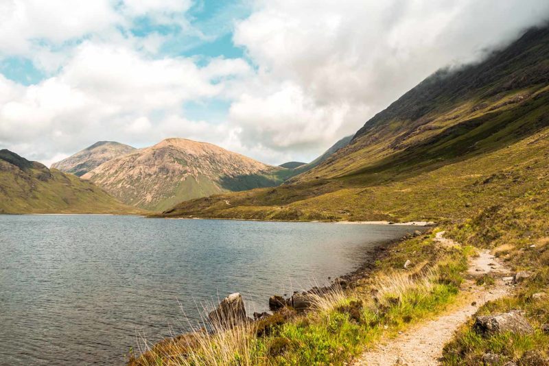
The strong sun from yesterday have give way to clouds laden with rain and I welcome the fresh atmosphere with pleasure. The bus drops me in Portree where I take a second small bus that drops me off at Sligachan, a tiny town with a hotel, a pub, a campsite and a youth hostel. I had planned to leave my big backpack at the campsite or at the hostel to make a return trip along the valley with my little bag. But the hostel is full and the campsite does not inspire me. I finally decide to cross the Glen with my big bag. Not having planned yesterday to walk with my big bag today, I find myself with a few extra kilos of food on my back. It has been almost five days since I did not walk with my big bag and I have a little trouble. Nevertheless, I plunge quietly through the valley under a threatening sky from which escapes some pretty rays of sun. The crossing is very beautiful, quite wild and austere and apart from thirty young people (scouts?), I do not meet many people. I walk along several lakes and arrive around 1pm at the small bay of Camasunary. Three buildings: a ruin, an inhabited house and a small Bothy. The hut looks a little bigger than Rubba Hunish, where I had lunch four days ago. A group of doe bask in the tall grass and I have lunch watching the mountains around me. To my right, Blabheinn, 929 meters is one of the highest mountains in Skye. It is possible to go up there. but not today, its top is in the clouds. If I come back to Skye, in addition to the Trotternish Ridge, I will come back to the Cuillin.
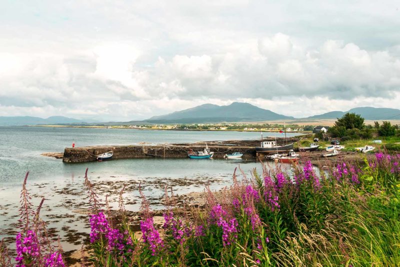
I leave the Skye Trail continuing along the cliffs on an eroded path joining Elgo, to reach Kilmarie over a small pass. The climb is not long but severe and I struggle a little. I find the road to Kilmarie where only five minutes are enough for me to be hitched by a young French woman. She drops me off at Broadford where I finally decide to abandon the idea of camping. It is going to rain in the night and having decided to skirt Loch Ness tomorrow, I have to join the continent tonight. I leave Skye behind me with a twinge in my heart and the feeling of not having had enough time to discover the island. Two stops later, a very nice lady finally drops me off at the Ratagan Youth Hostel. Here I am back on the continent. And in the center of the Highlands. The place is grandiose. And although I am a little disappointed to have left Skye so quickly and refreshed a bit by the quaint atmosphere of the hostel, I am very glad to be here. I am in the Kintail area and the hostel is located right on the edge of Loch Duich. In front of me are the mountains of the Five Sisters and Beinn Fhada. Many hiking trails exists through the mountains and I suddenly want to give up the idea of going along the Loch Ness tomorrow and instead walk around here. But it will rain tomorrow and climbing the mountains in the rain does not enchant me. Kintail is therefore to add to my list of places to come back for a future second trip to Scotland.
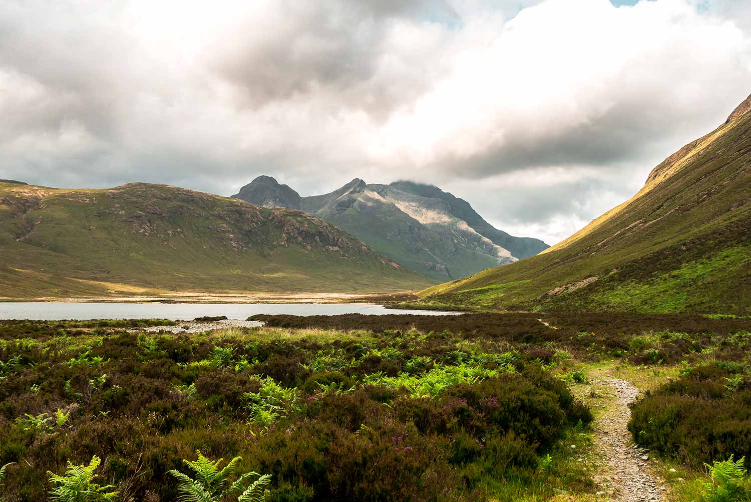
Glen Sligachan.
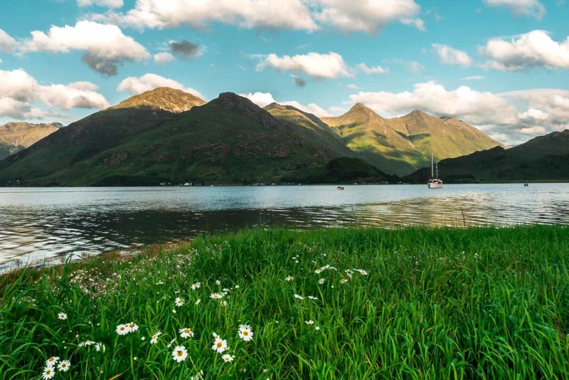
To the left, the coast towards Broadford and to the right, Loch Duich and the Five Sisters.