It is still raining when I start hiking at 11am. I must go otherwise I will take root at Am Bothan Bunkhouse. Today is the beginning of my second part on the Hebridean Way. Leverburgh looks sad under the rain. The path goes up in the bog between the hills but since it has been raining for two days, I decide to follow the road instead. I do not want to wade for hours in the middle of nowhere. Clearings are expected around noon but for now the rain is at its peak. Two kilometers later, I give up. The road is narrowing and walking next to cars is not very nice. And I am soaked. Such a nice way to start the day!
I hitchhike and a car takes me a few minutes later. My driver is a (male) nurse taking care of patients with dementia around the island. He comes from Stornoway, the big city of the Hebrides and has a patient to see in the area. He drops me off a little further away, in Northton, where I take refuge at the Temple View Café, a tiny little round stone cottage, waiting for the rain to pass. In the mist I distinguish the surrounding hills overlooking the place. The meadows is just by the sea and despite the gray weather it is very beautiful.
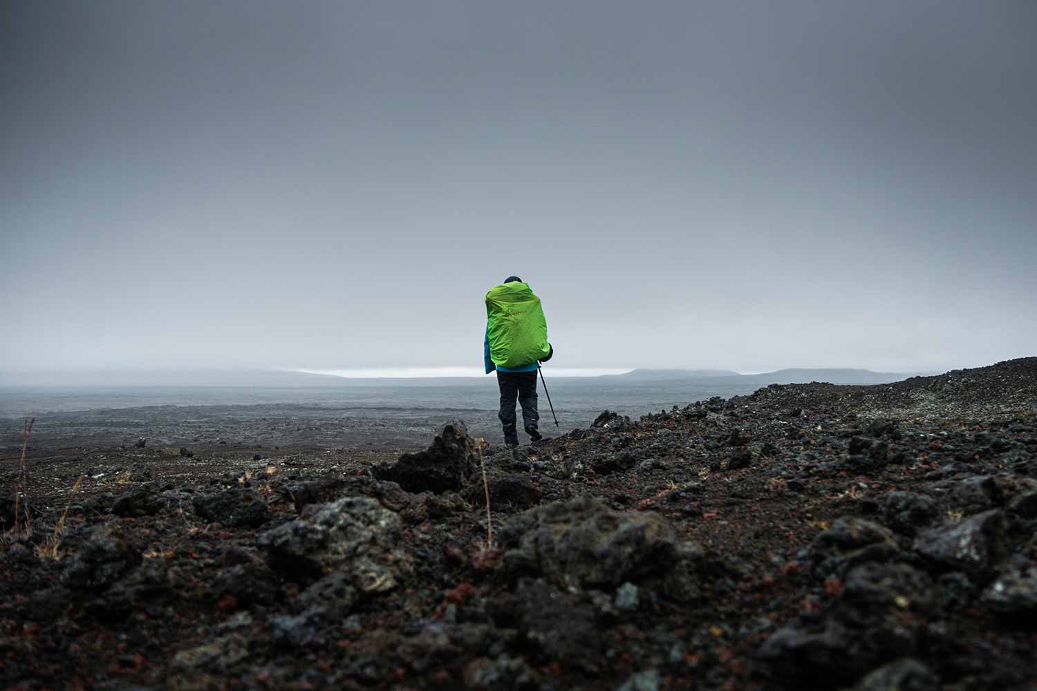
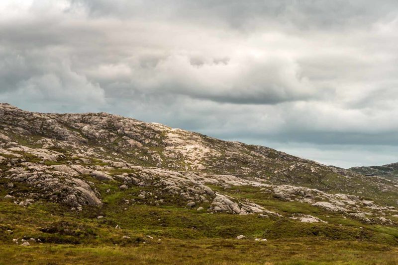
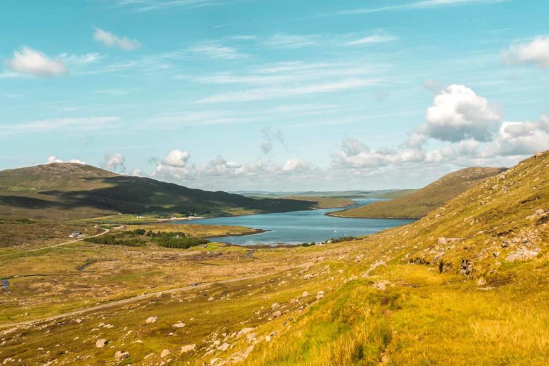
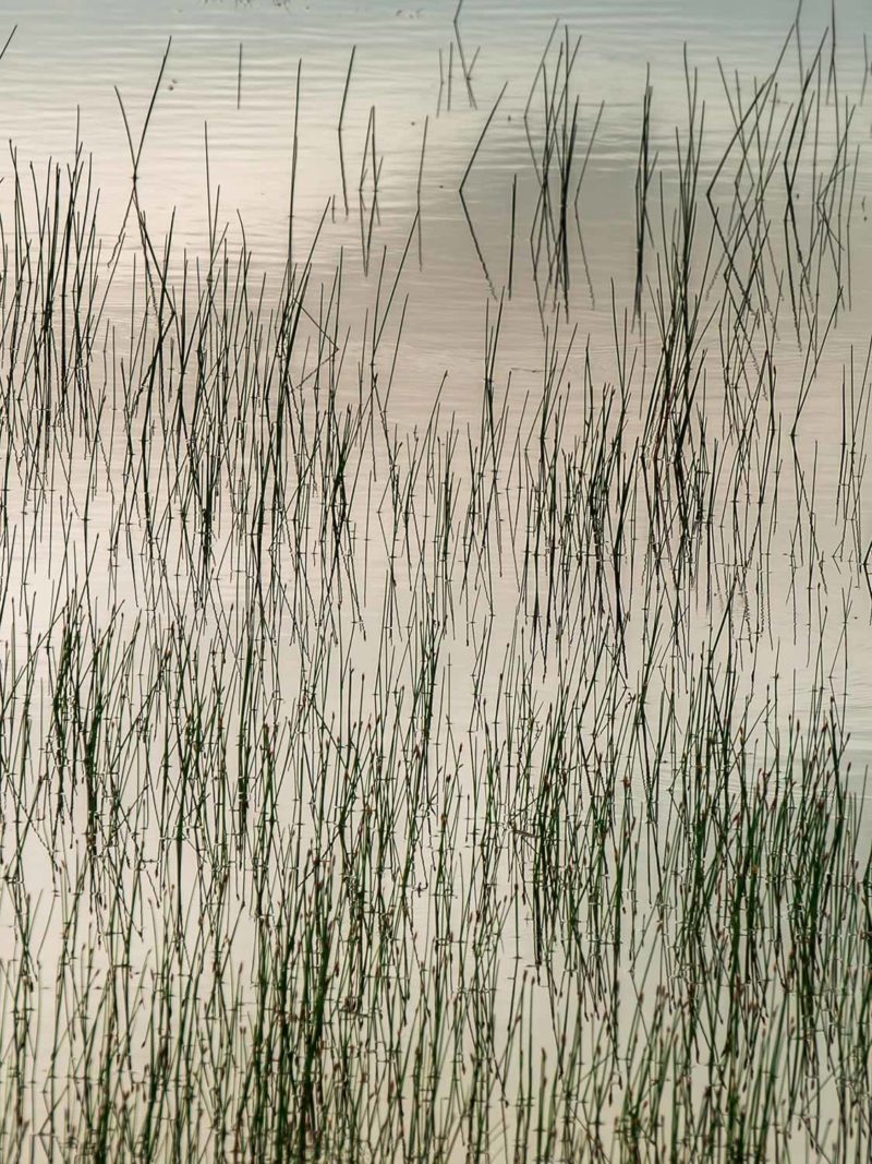
An hour later, I leave the place, the rain having calmed down a bit. I am back on the road for a few more kilometers before joining the path. White sand beaches gently appear through the mist. A car stops and offers me a lift! I only have one kilometer to go along the road but I accept. In Scarista, back on the trail, I start a small climb through the meadows to gain height. The ground is waterlogged and my shoes that must not be so waterproof anymore are slowly becoming soaked. The signposts are scarce and I squint my eyes at the landscape every ten minutes to find out where to go. The landscape is dotted with large white pebbles giving a slightly lunar atmosphere to the hills. Streams flow everywhere and I my feet are completely soaked. The Little Borve River even forces me to take off my shoes in order to cross it. The progression is a bit difficult on the hillside but after taking a last shower from an unhappy cloud, clearings finally appear! I feel much better and in the end, I realise, I have great fun crossing this soggy moor.
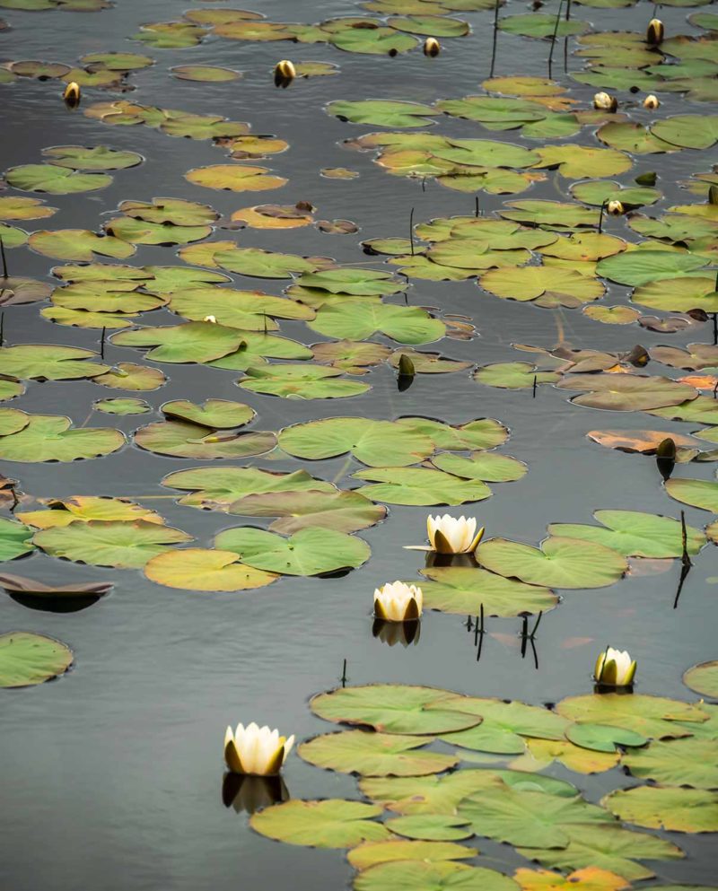
The sun illuminates the landscape at times making the place beautiful. I distinguish Horgabost and Sheileboist and the famous Luskentyre beach, apparently the most beautiful of the Hebrides. Large white sand beaches with turquoise waters surrounded by small mountains. It changes me a lot of landscapes crossed previously and I am very happy. In the end of the afternoon, I leave the path to reach the Horgabost campsite along the beach. The place seems heavenly if not for the hundred of tents and caravans who have taken up residence at the campsite. Still, the evening is quiet. I thought that maybe I could attend a sunset but not tonight. The sky is covered again and after a little tour in the dunes I retreat to my tent.
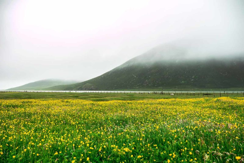
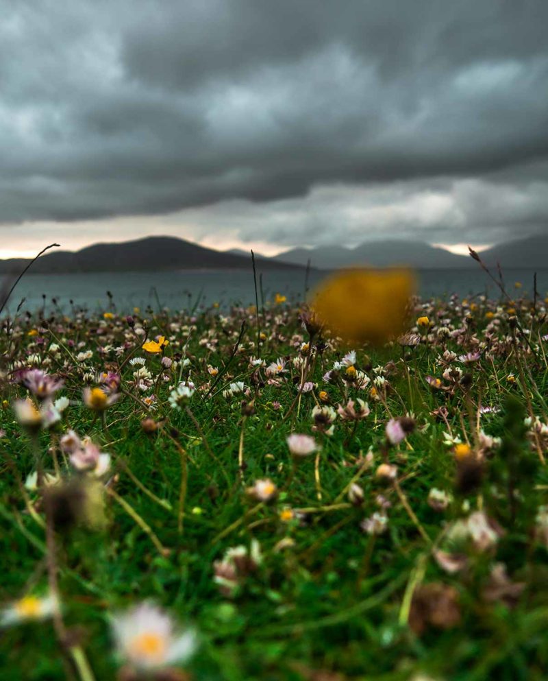
Horgabost beach.
Despite the forecast saying clouds and sun, the Hebrides sky has decided to focus on clouds. I go back to where I left the trail yesterday under a new threatening sky. Two backpacks walk across the moor and I get to know a couple of Swedes. These are the “third” hikers I meet on the way after Julie and Venula. A little more and I will feel like on the West Highland Way!
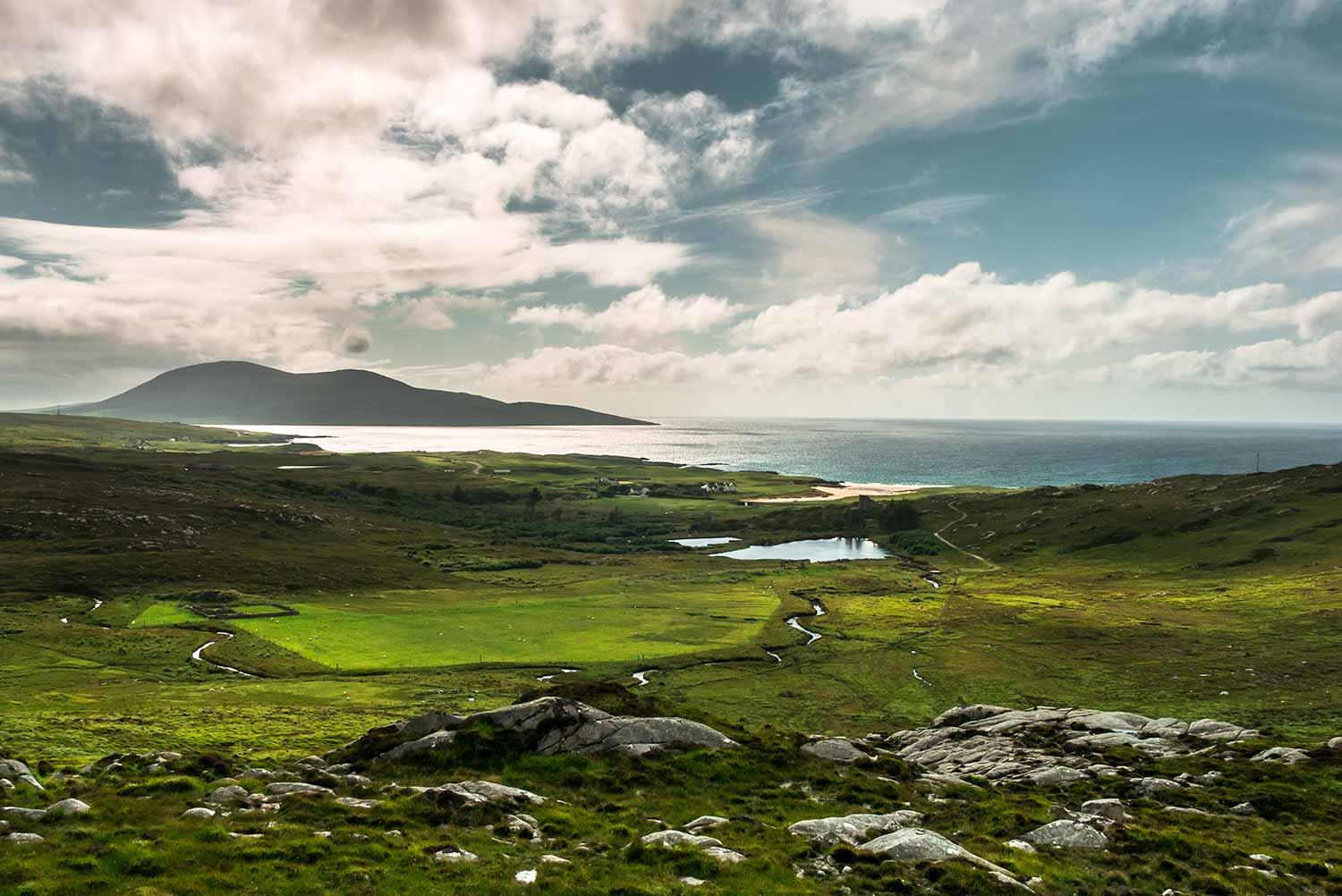
The path continues through the hills like yesterday and then climbs hard up to the top of Carran. From there, finally appears the most beautiful place of the Hebrides: Traigh Sheileboist, Traigh Losgaintir and Luskentyre beach, large expanses of white sands and turquoise waters. It is superb. I wait in vain for a ray of sunshine that does not come and then continue on my way. Coffin Route climbs gently to a small pass where I take a last look at the strait. Before continuing on the other side. Coffin Road was named after this name as the trail was once used by families living on the east coast of Harris (inhospitable and shallow soil) carrying their dead to bury them in the deeper soil of the west coast of Harris.
The old road turns into a path that descends slowly. It is a real hiking trail. Or at least what I expect from a hiking trail: small, well drawn, made of earth and stones and easy to follow. A real pleasure. The second only I have walked on since I arrived in Scotland. I go down quietly to the Bays, the east coast of Harris with tiny isolated villages. In the 19th century, the Hebrides were victims of “Highland Clearances”, forced displacements of the population to enlarge farmland. Entire villages were forced to leave their homes to make room for sheep farming. On Harris, families refusing to move were displaced in the Bays. Life was rough and difficult.
The landscape is almost lunar and there is not a sound. I reach the small road whose borders are covered with mussel shells. Small wind turbines scrape at full speed. In Lackalee, I meet my Swedish friends in front of a small closed cafe. I suddenly realize that tomorrow is Sunday and that my supply plans to Tarbert tomorrow noon are not gonna happen. Everything is closed on Sunday in the Hebrides. It’s Lord’s Day and the inhabitants of the islands are very respectful of the customs. I therefore risk being a bit limited on food quantities for a couple of days.
The Hebridean Way joins the Harris Way, a beautiful old path that crosses the lunar hills by the sea. The landscape is beautiful and there are ruins everywhere. I stop constantly to take pictures. It is quiet. No noise. But unlike last week, I do not find the places empty and monotonous. I enjoy this peaceful atmosphere walking quietly despite the appearing fatigue. My legs are a bit painful but I still have six kilometers to go before reaching the campground at Procrapool. I walk the hills then go down at Plocrapool and continue 600m before realizing that I passed the campsite. It was just at the junction of the road with the trail. I turn around and finally found a tiny campsite with very used blocks but functional and set up for the evening under a beautiful sun that has finally decided to appear. The day was long and difficult (twenty up and down kilometers) but it was by far the most beautiful day of the hike (for now).
Borve.
To the left, a view of Skye from Harris and to the right the typical Bays landscape.
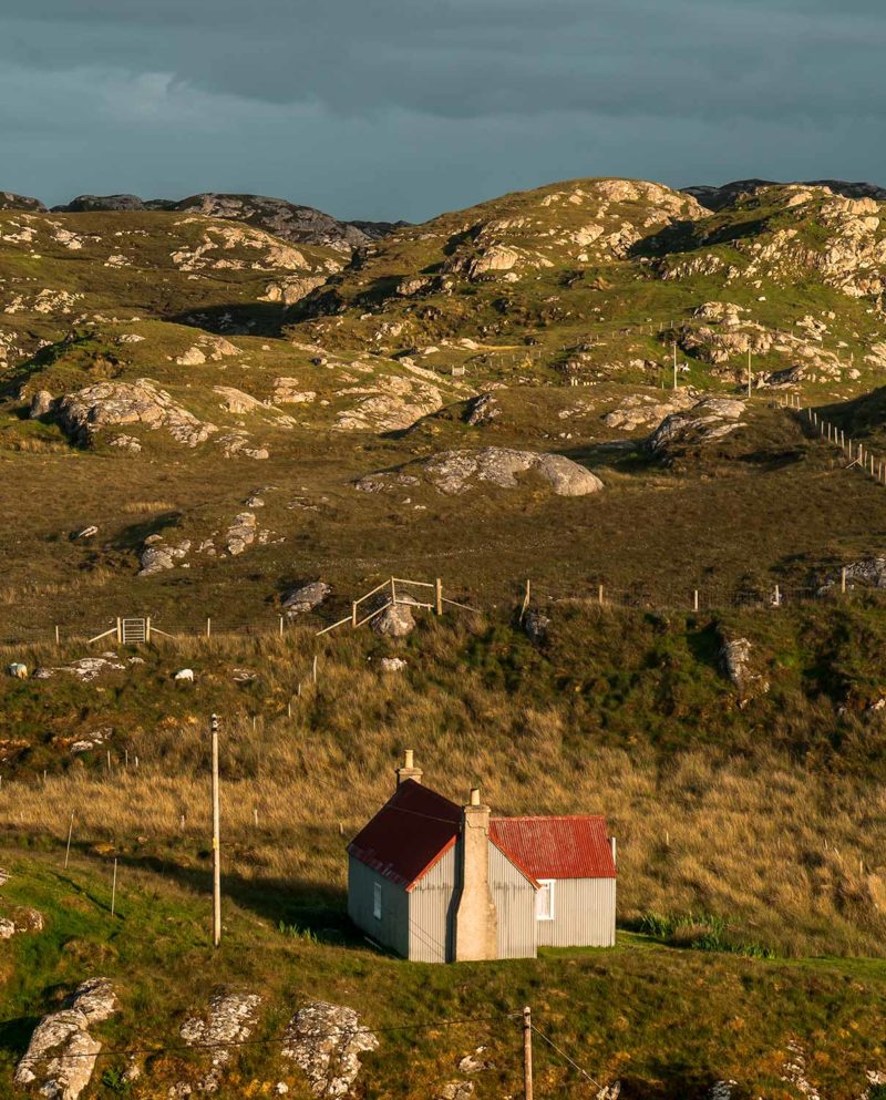
To the right, Procrapol and the tiny campsite.
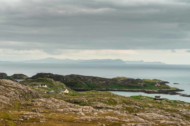
I leave the tiny campsite and continue on the road for a few kilometers before taking a small path along the sea side of the hill. The coast is very beautiful, dotted with small islets. The weather is nice with wind and some clouds. A perfect weather. In Caen Didig I reach the main road and decide to hitchhike to avoid the next five kilometers on the tarmac. A car stops a few minutes later. Christine and her three children are on vacation in the area and on their way to visit Scalpay Bay. That is great cause it is on my way. Christine has a contagious smile and we are chatting happily. We quickly pass Tarbert, the second largest city of the Hebrides and main seaport from where leave the ferry to Uig on Skye. I will come back in a few days having decided to go to Skye after the Hebrides. The village is modest in size with colorful houses and a quiet atmosphere.
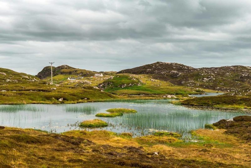
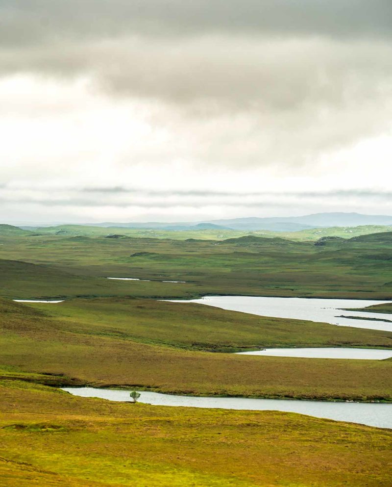
Christine drops me where the trail resumes offering me a ham sandwich, a peach and biscuits having learned that my supply plans have fallen short. I thank her kindness and sink into a beautiful valley where Loch Lacasdail stretches. At this point it is possible to make a diversion of about ten kilometers to reach Rhenigidale, where is the third Gatliff Youth Hostel (like those of Howmore and Berneray) located in an old building. The path to reach it runs along the cliffs and is apparently one of the most beautiful of Harris. Unfortunately, I do not have time to go there. It will be for next time. The path that I am on goes along the lake and up to a small pass to go down in the valley on the other side. An Cliseam, 799m, the highest mountain of the Hebrides is unveiled before my eyes. It is great weather and I am almost too hot. I join the small road at Maraig and climbs in the hills around Cleit Ard, before descending on Ardvourlie. The big Seaforth Loch stretching in the horizon.
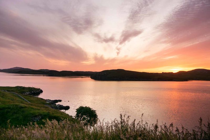
Having considered wild camping, I look for a place to pitch my tent but no luck, everything is wet or too windy. I fall back on Scaladale Center, a dormitory at the edge of the road but it is closed. In fact not quite, the front door is closed but not the back door. But it is desert, there is nobody. As it is Sunday, I have the impression that nobody works. The place looks more like a holiday center than a hostel. There is a tent, placed behind the building on the only flat ground available and almost sheltered from the wind but nobody inside. The place does not inspire me and as it is getting late and being tired, I decide to hitch a ride to reach Ravenspoint about thirty kilometers away. There is a hostel, there, where I booked previously a bed for tomorrow night. Two stops later, I arrived at Ravenspoint on the edge of Loch Eireasort. The hostel is open but again nobody. But the place seems much more welcoming and a message on a board informs me of the phone number to contact to inquire availability. I call and explain to the lady my story. No problem, the hostel is almost empty tonight, she will see me tomorrow for payment. I sit in the dormitory just for myself, feeling a lot better here.
But I feel a little bit guilty of not being able to do more wild camping. Since I arrived in Scotland, I did it only three times! It is really not much. But contrary to appearances, I find it difficult to find a suitable space to put the tent. It is always either too wet or too windy. And as I am alone, I prefer to feel good in the place where I camp. So in the end, I don’t do wild camping a lot. I wonder a little if I should rather try to harden myself and be less hesitant, it would be cheaper for me… But the quiet evening, the very nice hostel (a big cozy house), only me and a couple of English and especially an absolutely beautiful sunset on Loch Eireasort make me forget my doubts and I think that in the end I make the right choice by coming here tonight.
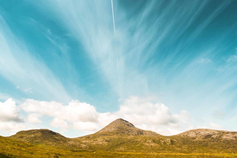
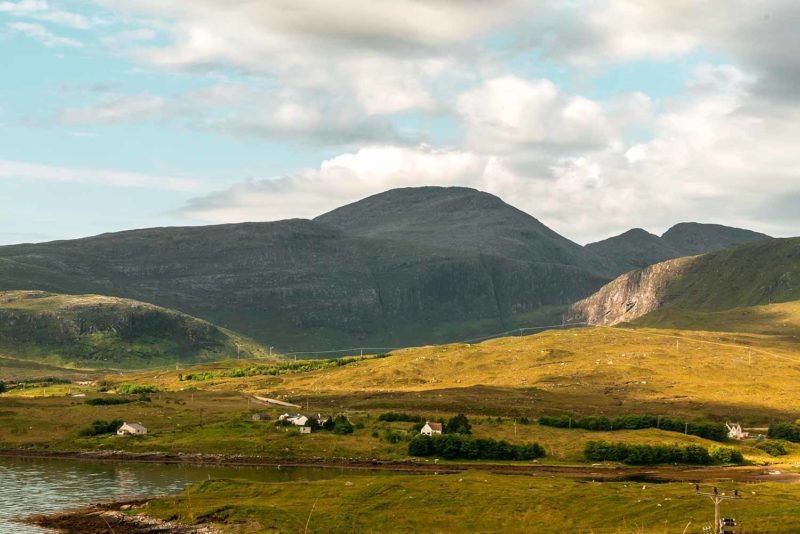
To the left, An Cliseam, the highest mountain in the Hebrides.
To the left, Seaforth Loch and to the right, Sunset over Ravenspoint.
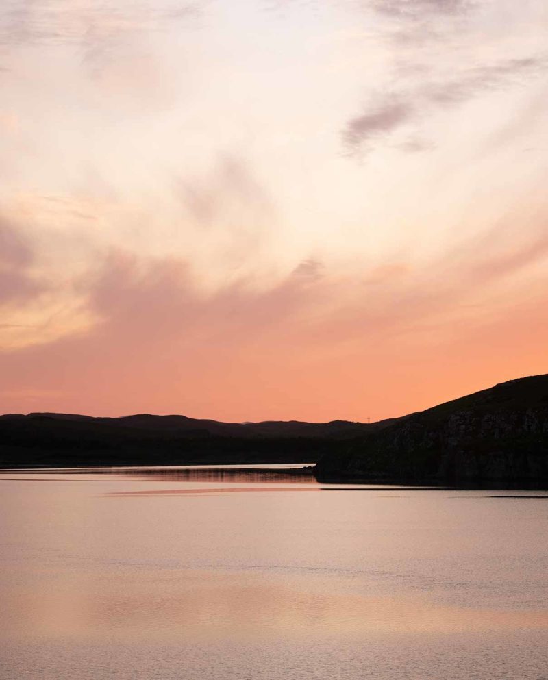
Sunset over Ravenspoint.
I leave my big bag at the Ravenspoint hostel and hitchhike back to Ardvourlie to continue the Hebridean Way to Balallan (the part of the path I jumped last night). But it is 8am and the Ravespoint Road is very small. There are not many people on it. Fortunately, ten minutes later, an English gentleman on holiday embarks me. He regularly comes spending his holiday in the area and tells me about his bike tours across Scotland and England. Going to Stornoway, he drops me off at Balallan. I walk a little along the road to see the Pairc Raiders memorial commemorating the courage of several crofters who rebelled against the restrictions of their land in 1887. From there I need a good twenty minutes before a car finally stops to take me to Ardvourlie. This is the bus driver from Tarbert – Stornoway! He is late for his job and drives a little too fast for my taste.
My first steps of the day make me cross the fictional border between Harris and Lewis. Both are in fact a big island, but the geographical difference (Harris is mountainous, Lewis is much flatter) and a simplification of Hebridean management areas have led to a fictitious separation. I walk along Loch Seaforth and then along Aline Community Woodland. The trees are half dead. From the top of Griamacleit (155m) I can see what is waiting for me: a return to the peat bogs. After two days in the mountains, it is over. I am disapointed a little and despite the fact that I do not have my big bag on the shoulders, I feel tired and weird. It is hot and humid and the sun is blinding me a bit. I go back to the pines and cross the small forest walking on a welcomed boardwalk. Below, it is the heather full of water. After several kilometers along the road on what remains of the old road, the path enters the moor on a “raised turf path” in bad condition. (A raised turf path is a pathway in Scottish peat plain, with two trenches on each side of a small elevated pathway trying to keep the central area dry. It is rarely the case). The crossing to Balallan is long, difficult and boring. I have only one desire: to finish. I finally reach the village where I wait at the intersection for a car to reach Ravenspoint more than ten kilometers away. But like in the morning, not many people. And nobody stops. I start to worry, telling myself that I will have to walk, but fortunately a nice lady end up stopping and brings me back to my hostel.
Unlike yesterday, the hostel is almost full tonight but I talk with people and enjoy a nice evening. A thirty-year-old Englishman tells me that he spent regularly his holidays at Beaucaire campsite, twenty years ago !! It is crazy, meeting someone at the other end of Scotland who visited Beaucaire (where my parents live). The world is small!
I leave Ravenspoint around 10am in the rain to reach, by bus, Laxay where I continue the path. These are the last kilometers of the Hebridean Way. As on my last day on the West Highland Way I feel happy. Happy to finish. After two weeks of walking, I am happy to arrive. Ten quiet kilometers in the wet plain to reach Achamore. Hopefully, the rain diminishes and despite the monotony and difficulty of the trail, I appreciate these last kilometers. From Achamore, about twenty kilometers separate me from Stornoway, the big city of the Hebrides and place of arrival of the trail. But these are along the road and I refuse to do them. It is way too long, dangerous and monotonous. I hitchhike and a gentleman and his dog Pip take me with them. The gentleman takes care of a brand new Bed & Breakfast, isolated on the west coast of Lewis. He tells me about his daily life, his multicultural clientele and I tell him about my trip. While I remind him of the fact that I did not walk the whole way he replies that there are two types of travelers: those who absolutely want to go from point A to point B and those who focus on the trip rather than the destination. Yes, I did not walk all the 247km of the Hebrides Way but it does not matter in the end. Because diversions, detours, hitchhikes or bus are part of the trip. They offer me meetings, exchanges, discoveries, much more important than just walk from point A to point B. A revelation opens up to me, erasing at the same time a lot of doubts and questions that I had while walking these two weeks.
In Stornoway, I reach the Web Hostel, a beautiful hostel in a big house where I meet Julie, the American hiker I met several days ago. The manager comes to see me and gives me a letter written in French from Marie, the French cyclist met on Berneray with whom I had a good contact! She was at the hostel last night and left for two days of cycling on Lewis. She wrote me her email and invites me to contact her! What I do right away, being very happy to hear from her. Her answer is not long and she informs me that she will come back to Stornoway tomorrow evening and asks me to reserve a bed for her at the hostel. I am very happy with all of this and to be able to see Julie and Marie again! The evening is quiet and Julie and I go eat outside in an Indian restaurant. The food is good and I fall asleep, happy to have arrived and with the sequence of events.
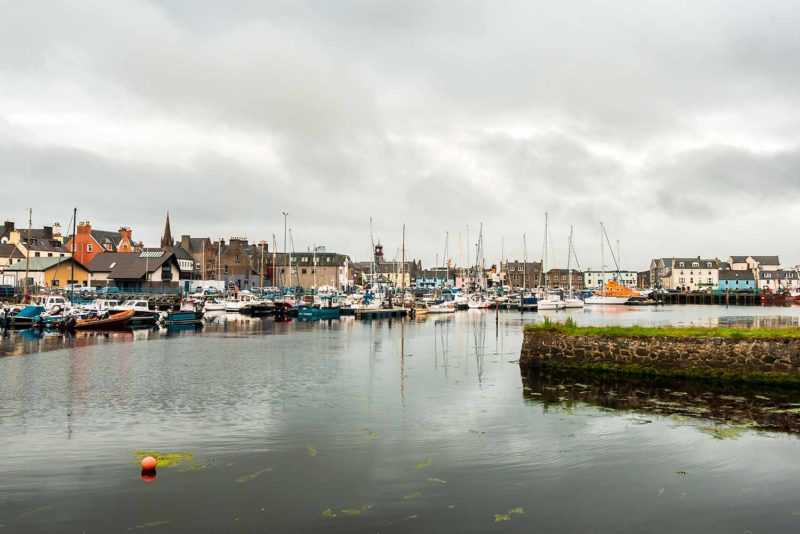
On the left, Ardvoulie and on the left, the port of Stornoway.
Hi, I travelled through hebrides every year fof 8 years sep, October wild camping in campervan, been all over the world from 89 to 2010 every winter for 4 months at a time, there’s no where I travelled to and spent time in than the hebrides, its magical, timeless, mysterious, theres not one part of the islands or the folk that’s not bang on! I’m planning a trip sep/Oct 2021,cheers, great feature and photos.
Thank you Phill ! Good luck for your next travel.